MyTopo
Red River Pass New Mexico US Topo Map
Couldn't load pickup availability
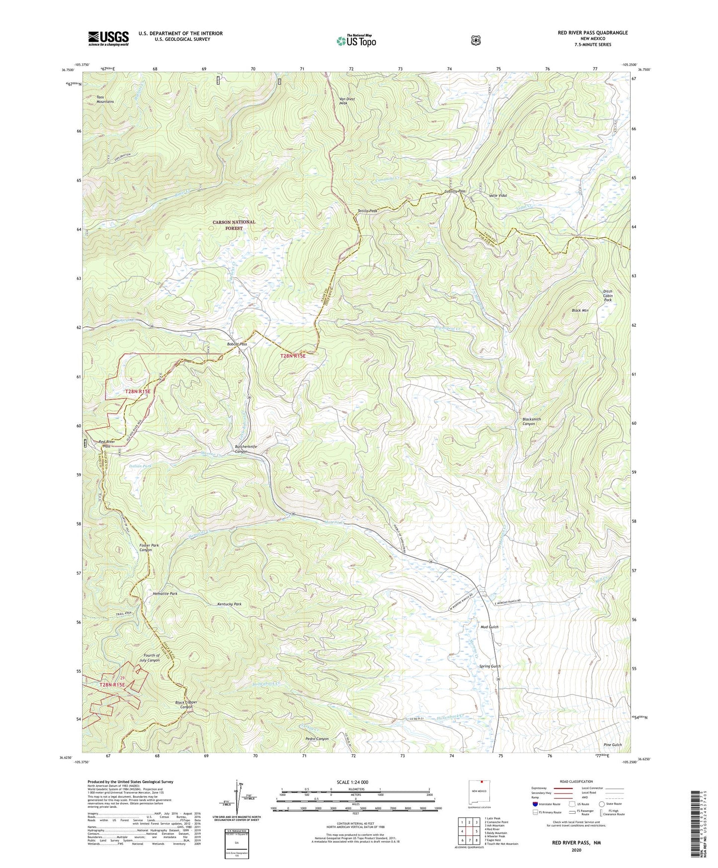
2020 topographic map quadrangle Red River Pass in the state of New Mexico. Scale: 1:24000. Based on the newly updated USGS 7.5' US Topo map series, this map is in the following counties: Colfax, Taos. The map contains contour data, water features, and other items you are used to seeing on USGS maps, but also has updated roads and other features. This is the next generation of topographic maps. Printed on high-quality waterproof paper with UV fade-resistant inks.
Quads adjacent to this one:
West: Red River
Northwest: Latir Peak
North: Comanche Point
Northeast: Ash Mountain
East: Baldy Mountain
Southeast: Touch-Me-Not Mountain
South: Eagle Nest
Southwest: Wheeler Peak
Contains the following named places: Big Bobcat Creek, Bitter Creek Mining Company, Black Copper Group, Black Mountain, Black Wizard, Blacksmith Canyon, Bobcat Pass, Boston Queen Prospect, Butcherknife Canyon, Challenge, Cora Gibson, Costilla Pass, Deldosso Prospect, Ditch Cabin Park, Elizabeth Mine, Elladora, Emerald, Enchanted Forest Cross Country Ski Area, Enderman Prospect, Enterprise, Foster Park, Free Gold, Gem Number Two, Gold Bell, Gold King Number Two, Gold Leaf, Green Meadows, Harmon, Heck, Hematite, Hematite Creek, Hematite Park, Hematite Post Office, Hemitite Chief, Hidden Treasure, Hollenback Creek, Huntingtonia, Independence, Independence Mine, Iron Bird, Italian Park, Jacks and Sixes Group, Kentucky Park, King Yellow Jacket, Labor Exchange, Little Bobcat Creek, Manzanita, Memphis, Memphis Mine, Mill Creek, Misery, Monitor, Moreno, Moreno Ranch, Mud Gulch, Mutz Ranch, Neptune, North Moreno Creek, O K, Ottumay, Pine Gulch, Prichard, Red River Pass, Royal, Silver Queen Prospect, Spring Gulch, Taos Mountains, Tetilla Peak, Tyroler, Van Diest Peak, Varida Group