MyTopo
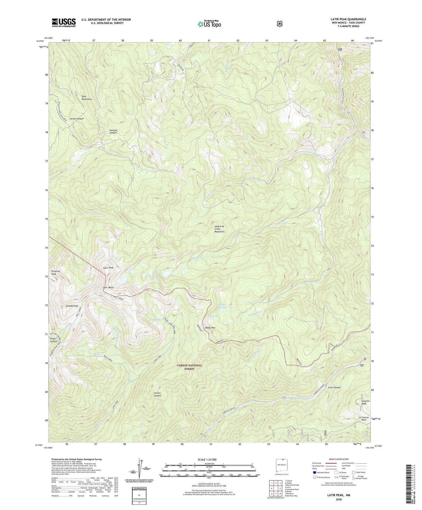
Latir Peak New Mexico US Topo Map
Couldn't load pickup availability
Also explore the Latir Peak Forest Service Topo of this same quad for updated USFS data
2023 topographic map quadrangle Latir Peak in the state of New Mexico. Scale: 1:24000. Based on the newly updated USGS 7.5' US Topo map series, this map is in the following counties: Taos. The map contains contour data, water features, and other items you are used to seeing on USGS maps, but also has updated roads and other features. This is the next generation of topographic maps. Printed on high-quality waterproof paper with UV fade-resistant inks.
Quads adjacent to this one:
West: Cerro
Northwest: Costilla
North: Amalia
Northeast: Big Costilla Peak
East: Comanche Point
Southeast: Red River Pass
South: Red River
Southwest: Questa
This map covers the same area as the classic USGS quad with code o36105g4.
Contains the following named places: Baldy Blue Lake, Baldy Cabin, Baldy Mountain, Baldy Peak Claim Mine, Bear Lake, Billy Goat Claim, Bull Creek, Greenie Peak, Heart Lake, Jiron Canyon, Lagunitas Fork, Latir Claim, Latir Creek, Latir Lakes, Latir Mesa, Latir Peak, Latir Rock Cairn, Lemos Creek, Midnight Creek, Questa Division, Rio Costilla Ski Area, Rito Claro, South Latir Lake, Spanish Main Prospect, Venado Peak, Virgin Canyon, Virsylvia Peak, ZIP Code: 87556