MyTopo
Sacaton Draw New Mexico US Topo Map
Couldn't load pickup availability
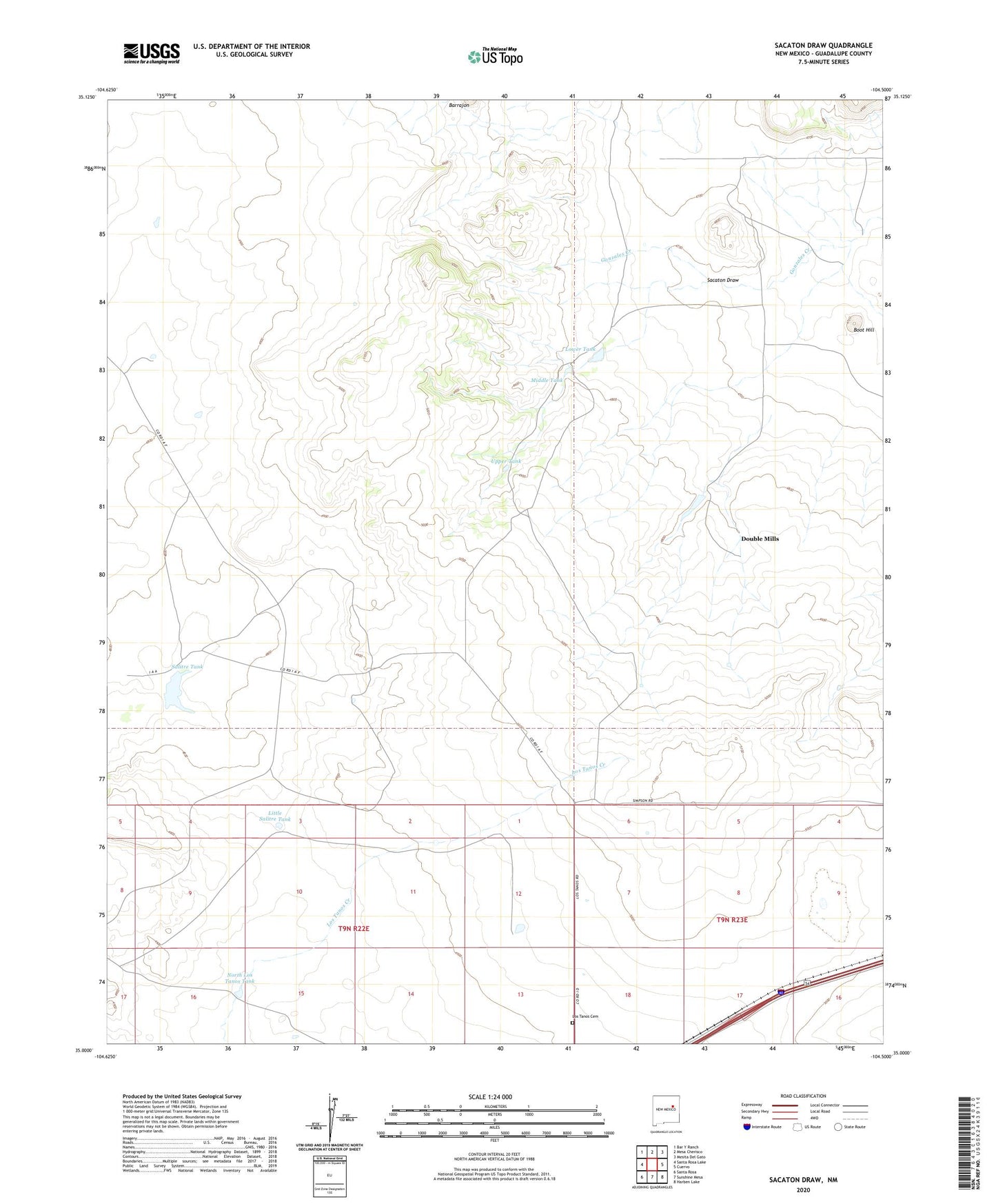
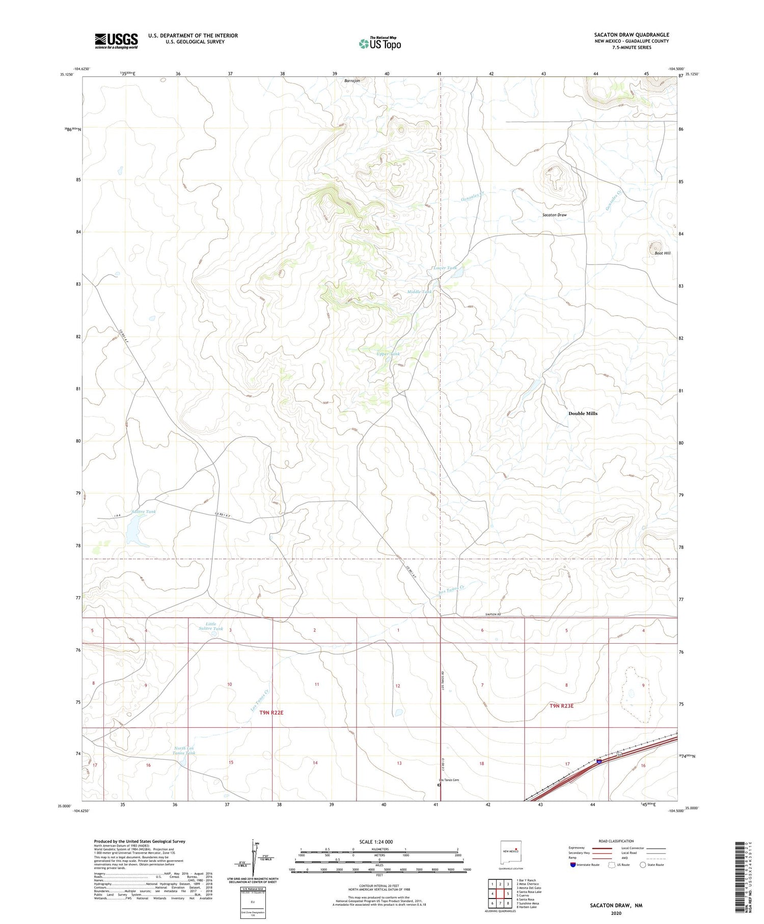
2020 topographic map quadrangle Sacaton Draw in the state of New Mexico. Scale: 1:24000. Based on the newly updated USGS 7.5' US Topo map series, this map is in the following counties: Guadalupe. The map contains contour data, water features, and other items you are used to seeing on USGS maps, but also has updated roads and other features. This is the next generation of topographic maps. Printed on high-quality waterproof paper with UV fade-resistant inks.
Quads adjacent to this one:
West: Santa Rosa Lake
Northwest: Bar Y Ranch
North: Mesa Cherisco
Northeast: Mesita Del Gato
East: Cuervo
Southeast: Harben Lake
South: Sunshine Mesa
Southwest: Santa Rosa
Contains the following named places: Boot Hill, Canyon Tank, Double Mills, East Hill Well, Gonzales Camp, Little Salitre Tank, Los Tanos Cemetery, Lower Tank, Middle Tank, Nip Well, North Los Tanos Tank, Preston Beck Grant Quarry, Ratcliff Ranch, Ratliff, Sacaton Draw, Salitre Tank, Shamrock Pumping Station, Spires Ranch, Upper Tank