MyTopo
Mesita Del Gato New Mexico US Topo Map
Couldn't load pickup availability
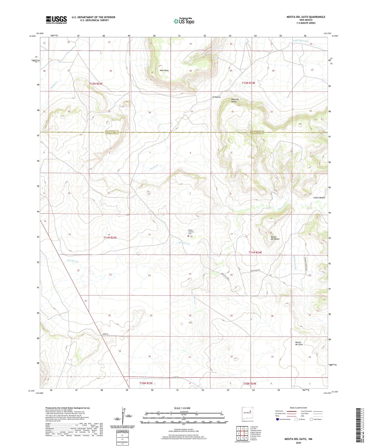
2023 topographic map quadrangle Mesita Del Gato in the state of New Mexico. Scale: 1:24000. Based on the newly updated USGS 7.5' US Topo map series, this map is in the following counties: Guadalupe, San Miguel. The map contains contour data, water features, and other items you are used to seeing on USGS maps, but also has updated roads and other features. This is the next generation of topographic maps. Printed on high-quality waterproof paper with UV fade-resistant inks.
Quads adjacent to this one:
West: Mesa Cherisco
Northwest: Mesa Pino
North: La Silla
Northeast: Bookout Ranch
East: Neafus Ranch
Southeast: Newkirk
South: Cuervo
Southwest: Sacaton Draw
This map covers the same area as the classic USGS quad with code o35104b4.
Contains the following named places: Benton Ranch, Bookout Ranch Section 31, Canon Bonita, Cherisco Creek, Difrises Arroyo, El Puerto, Gonzales Creek, Green Well, Hage Ranch, Lookout Ranch Section Twenty Five, Mesa del Medio, Mesita del Gato, Mesita del Medio, Monte Calvario Cemetery, New Well, Pino Creek, Puerto Creek, Puerto Windmill, Santa Rosa Claims, West Mesa, Yates Ranch