MyTopo
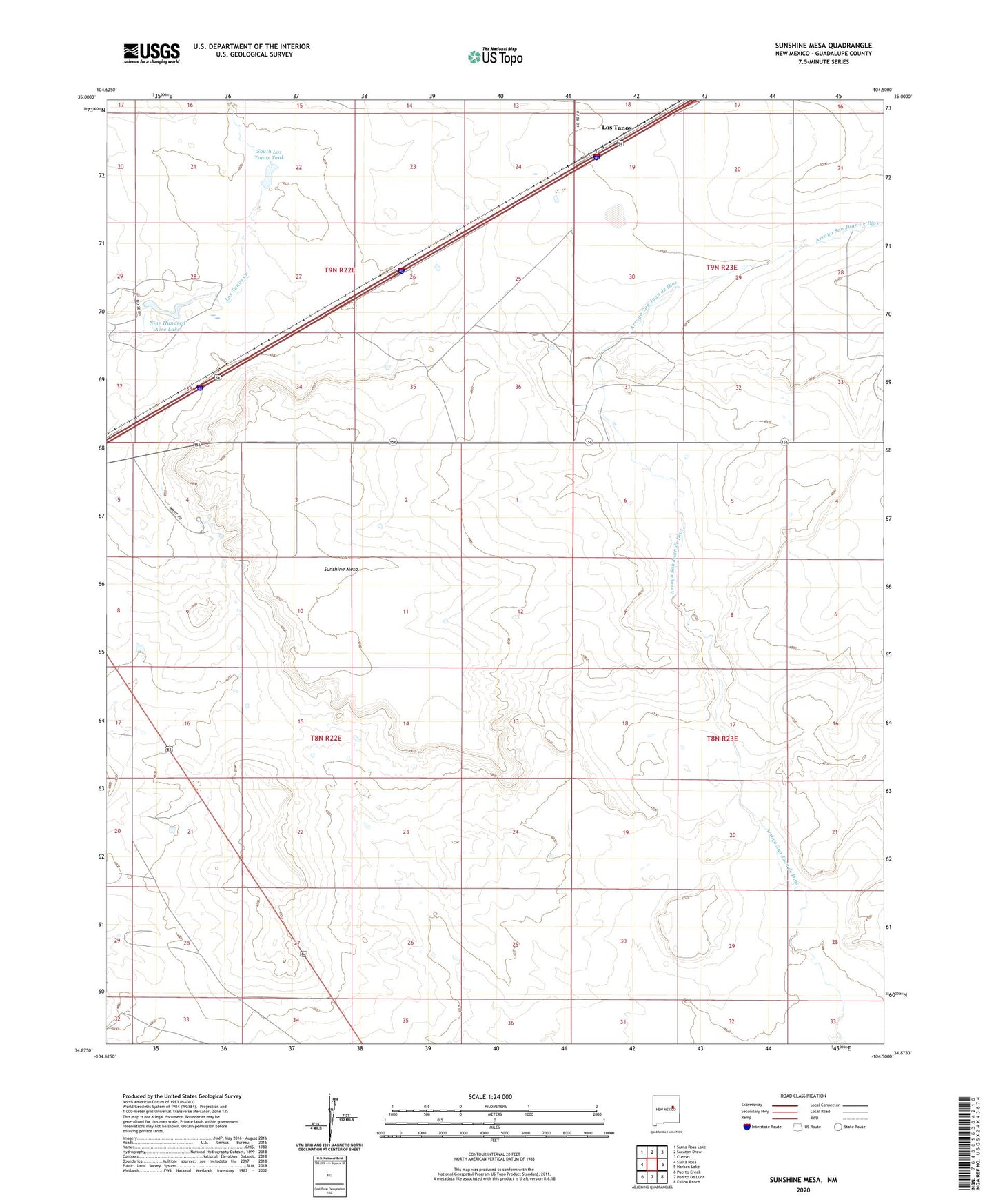
Sunshine Mesa New Mexico US Topo Map
Couldn't load pickup availability
2023 topographic map quadrangle Sunshine Mesa in the state of New Mexico. Scale: 1:24000. Based on the newly updated USGS 7.5' US Topo map series, this map is in the following counties: Guadalupe. The map contains contour data, water features, and other items you are used to seeing on USGS maps, but also has updated roads and other features. This is the next generation of topographic maps. Printed on high-quality waterproof paper with UV fade-resistant inks.
Quads adjacent to this one:
West: Santa Rosa
Northwest: Santa Rosa Lake
North: Sacaton Draw
Northeast: Cuervo
East: Harben Lake
Southeast: Fallon Ranch
South: Puerto De Luna
Southwest: Puerto Creek
This map covers the same area as the classic USGS quad with code o34104h5.
Contains the following named places: Big Spring Pasture Windmill, East Buck Trap Windmill, Little Spring Pasture Windmill, Los Tanos, Los Tanos Post Office, Los Tanos Windmill, Middle Buck Trap Windmill, Moorhouse Ranch, Nine Hundred Acre Lake, Santa Rosa Division, Smith Place Windmill, South Los Tanos Tank, Sunshine Mesa, Top Strip Windmill, West Buck Trap Windmill