MyTopo
San Felipe Pueblo New Mexico US Topo Map
Couldn't load pickup availability
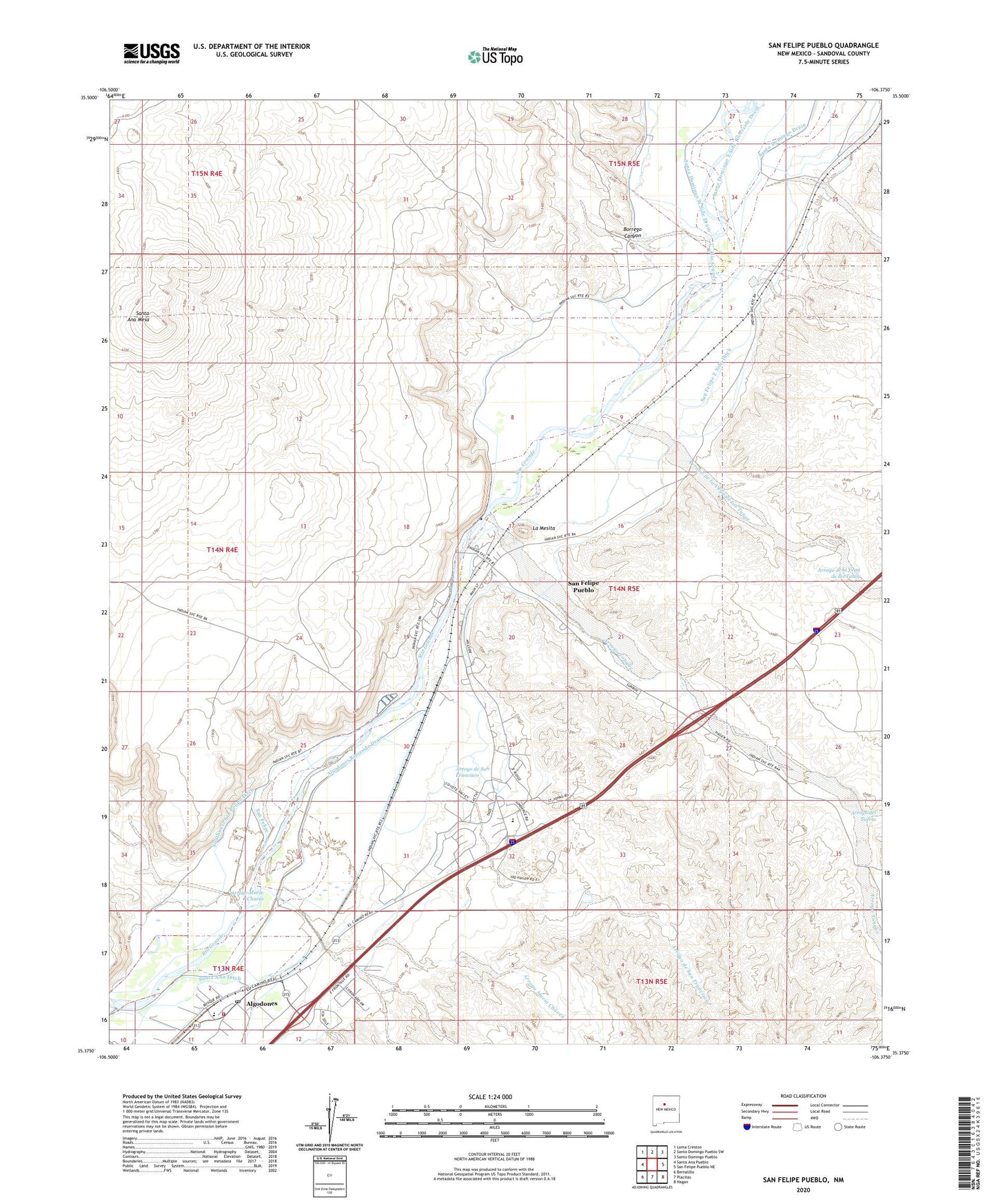
2020 topographic map quadrangle San Felipe Pueblo in the state of New Mexico. Scale: 1:24000. Based on the newly updated USGS 7.5' US Topo map series, this map is in the following counties: Sandoval. The map contains contour data, water features, and other items you are used to seeing on USGS maps, but also has updated roads and other features. This is the next generation of topographic maps. Printed on high-quality waterproof paper with UV fade-resistant inks.
Quads adjacent to this one:
West: Santa Ana Pueblo
Northwest: Loma Creston
North: Santo Domingo Pueblo SW
Northeast: Santo Domingo Pueblo
East: San Felipe Pueblo NE
Southeast: Hagan
South: Placitas
Southwest: Bernalillo
Contains the following named places: 10011 Water Well, 10012 Water Well, Algodones, Algodones Census Designated Place, Algodones Post Office, Algodones Power Plant, Algodones Riverside Drain, Algodones Volunteer Fire Department, Angostura Grant, Arroyo de la Vega de los Tanos, Arroyo de San Francisco, Arroyo del Tuerto, Arroyo Maria Chavez, Arroyo Tonque, Borrego Canyon, Borrego Wasteway, Casino Hollywood, Elota, Elota Lateral, La Mesita, REA Water Well 1, REA Well 3 Water Well, San Felipe Canal, San Felipe East Side Ditch, San Felipe Post Office, San Felipe Pueblo, San Felipe Pueblo Census Designated Place, San Felipe Pueblo Grant, San Felipe Riverside Drain, Santa Ana Ditch, Santa Ana Mesa, Santa Rosa De Cubero Grant, Santo Domingo Drain, Southwest San Felipe Ditch, Yeso Lateral