MyTopo
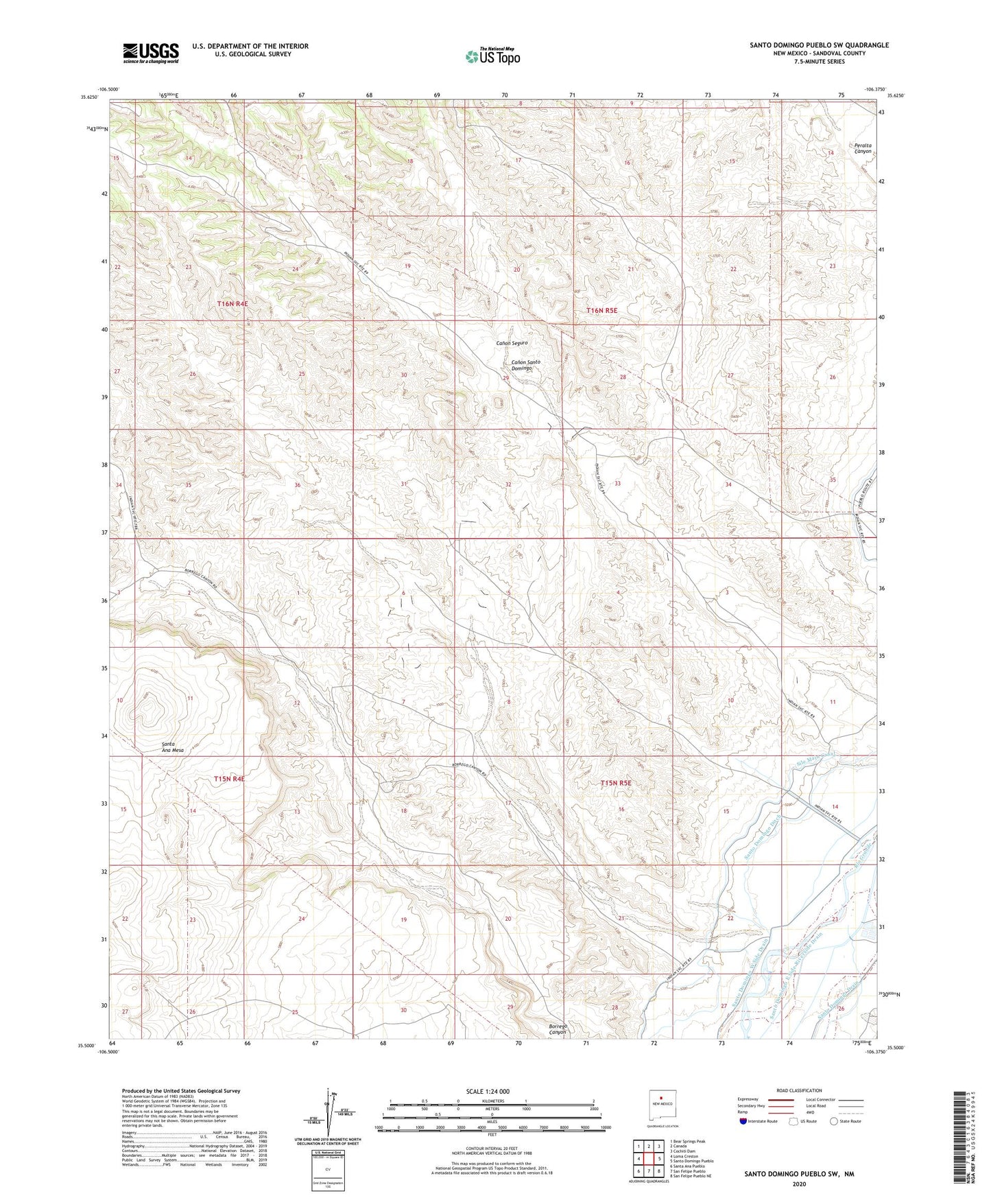
Santo Domingo Pueblo SW New Mexico US Topo Map
Couldn't load pickup availability
Also explore the Santo Domingo Pueblo SW Forest Service Topo of this same quad for updated USFS data
2023 topographic map quadrangle Santo Domingo Pueblo SW in the state of New Mexico. Scale: 1:24000. Based on the newly updated USGS 7.5' US Topo map series, this map is in the following counties: Sandoval. The map contains contour data, water features, and other items you are used to seeing on USGS maps, but also has updated roads and other features. This is the next generation of topographic maps. Printed on high-quality waterproof paper with UV fade-resistant inks.
Quads adjacent to this one:
West: Loma Creston
Northwest: Bear Springs Peak
North: Canada
Northeast: Cochiti Dam
East: Santo Domingo Pueblo
Southeast: San Felipe Pueblo NE
South: San Felipe Pueblo
Southwest: Santa Ana Pueblo
This map covers the same area as the classic USGS quad with code o35106e4.
Contains the following named places: Canon Seguro, Santo Domingo Ditch, Santo Domingo East Side Riverside Drain, Santo Domingo Pueblo, Santo Domingo West Side Drain, Santo Domingo-San Felipe Division, Sile Main Canal, ZIP Code: 87072