MyTopo
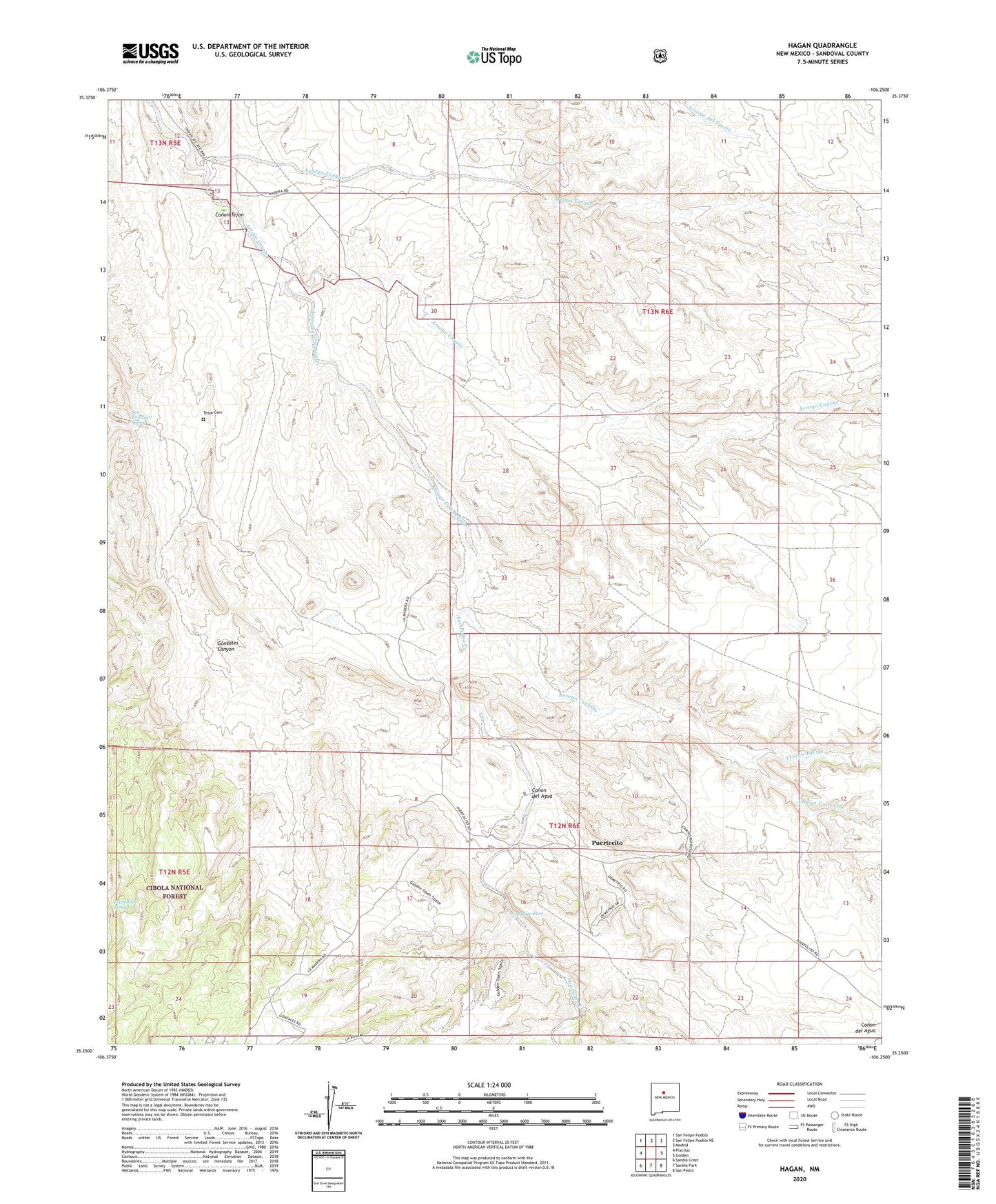
Hagan New Mexico US Topo Map
Couldn't load pickup availability
Also explore the Hagan Forest Service Topo of this same quad for updated USFS data
2023 topographic map quadrangle Hagan in the state of New Mexico. Scale: 1:24000. Based on the newly updated USGS 7.5' US Topo map series, this map is in the following counties: Sandoval. The map contains contour data, water features, and other items you are used to seeing on USGS maps, but also has updated roads and other features. This is the next generation of topographic maps. Printed on high-quality waterproof paper with UV fade-resistant inks.
Quads adjacent to this one:
West: Placitas
Northwest: San Felipe Pueblo
North: San Felipe Pueblo NE
Northeast: Madrid
East: Golden
Southeast: San Pedro
South: Sandia Park
Southwest: Sandia Crest
This map covers the same area as the classic USGS quad with code o35106c3.
Contains the following named places: A Placer, Arroyo Coyote, Arroyo Cuchillo, Arroyo Seco, Arroyo Tuerto, Arroyo Una de Gato, Arroyo Val Verde, Canon del Agua, Canon Tejon, Coyote, Coyote Mine, Crummy Number One Prospect, Diamond Tail, Diamond Tail Project, Diamond Tail Ranch, Donnell Prospect, Escondido Spring, Gonzales Canyon, Hagan, Hagan Mines, Hagan Post Office, Herrera, La Madera Fire Station, Mimi Number Four Prospect, New Mexico Placer, Perini Prospect, Puertecito, San Francisco Spring, San Pedro Creek, Sloan Mine, Tejon, Tejon Cemetery, Tejon Number Two Mine, Tonque Pueblo, Town of Tejon Grant, Una de Gato, Uranium Prospect, ZIP Code: 87047