MyTopo
Sixteenmile Draw East New Mexico US Topo Map
Couldn't load pickup availability
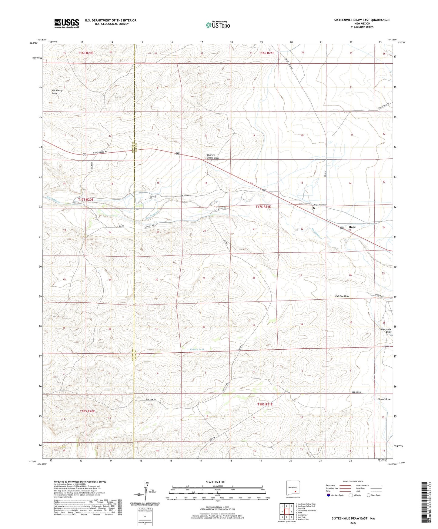
2020 topographic map quadrangle Sixteenmile Draw East in the state of New Mexico. Scale: 1:24000. Based on the newly updated USGS 7.5' US Topo map series, this map is in the following counties: Eddy, Chaves. The map contains contour data, water features, and other items you are used to seeing on USGS maps, but also has updated roads and other features. This is the next generation of topographic maps. Printed on high-quality waterproof paper with UV fade-resistant inks.
Quads adjacent to this one:
West: Sixteenmile Draw West
Northwest: Sagebrush Valley West
North: Sagebrush Valley East
Northeast: Hope NW
East: Hope
Southeast: Antelope Sink
South: Holt Tank
Southwest: Encino Draw
Contains the following named places: Anderson Young Ranch, Catclaw Draw, Charley White Draw, Cox Ranch, Crockett Ranch, Deep Well, Harris Ranch, Hope Community Canal, Hope West Cemetery, Hunter Ranch, Joe Young Ranch, Penasco Well, Sixteen Tank, Teel Ranch, Walnut Ranch Well