MyTopo
Springer New Mexico US Topo Map
Couldn't load pickup availability
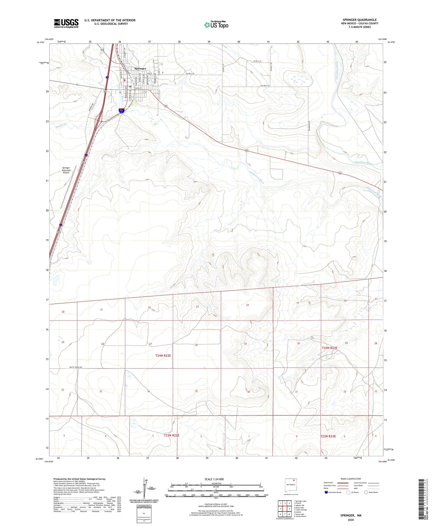
2023 topographic map quadrangle Springer in the state of New Mexico. Scale: 1:24000. Based on the newly updated USGS 7.5' US Topo map series, this map is in the following counties: Colfax. The map contains contour data, water features, and other items you are used to seeing on USGS maps, but also has updated roads and other features. This is the next generation of topographic maps. Printed on high-quality waterproof paper with UV fade-resistant inks.
Quads adjacent to this one:
West: Pinon Hills
Northwest: Springer Lake
North: French
Northeast: Abbott NW
East: Taylor Springs
Southeast: Jaritas Ranch
South: Stony Lake
Southwest: Colmor
This map covers the same area as the classic USGS quad with code o36104c5.
Contains the following named places: Colfax General Hospital Library, Forrester Elementary School, Iglesia Bautista Betania Baptist, Maldonado Pit, New Mexico Boys School Library, Robinson, Salado Creek, Santa Fe Trail, Santa Fe Trail Museum and Historical Society, Springer, Springer Fire Department, Springer High School, Springer Historical Marker, Springer Municipal Airport, Springer Pit, Springer Police Department, Springer Post Office, Springer Volunteer Emergency Medical Services, Springer Weather Station, State Boys School Area 1, Town of Springer, Wilferth Middle School