MyTopo
Tooth of Time New Mexico US Topo Map
Couldn't load pickup availability
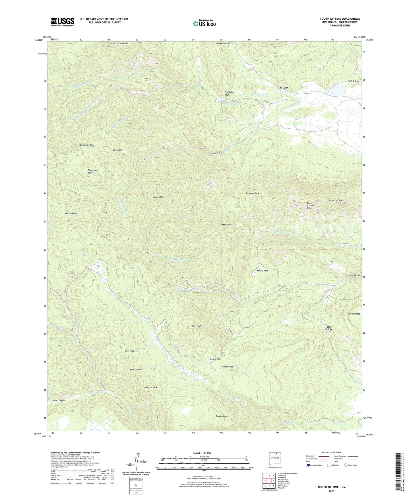
2020 topographic map quadrangle Tooth of Time in the state of New Mexico. Scale: 1:24000. Based on the newly updated USGS 7.5' US Topo map series, this map is in the following counties: Colfax. The map contains contour data, water features, and other items you are used to seeing on USGS maps, but also has updated roads and other features. This is the next generation of topographic maps. Printed on high-quality waterproof paper with UV fade-resistant inks.
Quads adjacent to this one:
West: Garcia Peak
Northwest: Touch-Me-Not Mountain
North: Ute Park
Northeast: Cimarron
East: Coyote Mesa
Southeast: Rayado
South: White Peak
Southwest: Agua Fria Peak
Contains the following named places: Agua Fria Creek, Aguila Camp, Apache Creek, Bear Canyon, Bear Cave Camp, Bear Creek, Bear Mountain, Beaubien Camp, Beaver Ponds, Black Mountain, Black Mountain Camp, Bonito Cow Camp, Bonito Creek, Bonito Peak, Buck Creek, Burn Peak, Cathedral Rock, Cathedral Rock Campground, Cimarroncito Base Camp, Cimarroncito Camp, Cimarroncito Peak, Cimarroncito Reservoir, Cimarroncito Reservoir Dam, Clarks Fork Creek, Clarks Fork Site Number 2 Dam, Clarks Fork Trail Camp, Comanche Pass, Crater Lake Camp, Cyphers Mine, Cyphers Mine Camp, Fish Camp, Fowler Mesa, Fowler Pass, Grizzly Tooth, Hidden Valley, Jeff Creek, Lambert Mine Camp Site, Lookout Meadows Camp, Lookout Peak, Lovers Leap, Lovers Leap Camp, Lower Bonito Camp, Middle Fork Cimarroncito Creek, Miners Park, Miners Park Camp, New Abreu Camp, North Fork Cimarroncito Creek, North Fork Urraca Camp, Old Abreu Camp, Phillips Junction, Ponderosa Camp, Rayado Peak, Rimrock Park Camp, Shaefers Peak, South Fork Cimarroncito Creek, Stone Wall Pass, Tooth of Time, Trail Peak, Urraca Dam, Ute Gulch, Webster Dam, Webster Pass, Webster Reservoir, Window Rock