
MyTopo
Truchas Peak New Mexico US Topo Map
Couldn't load pickup availability
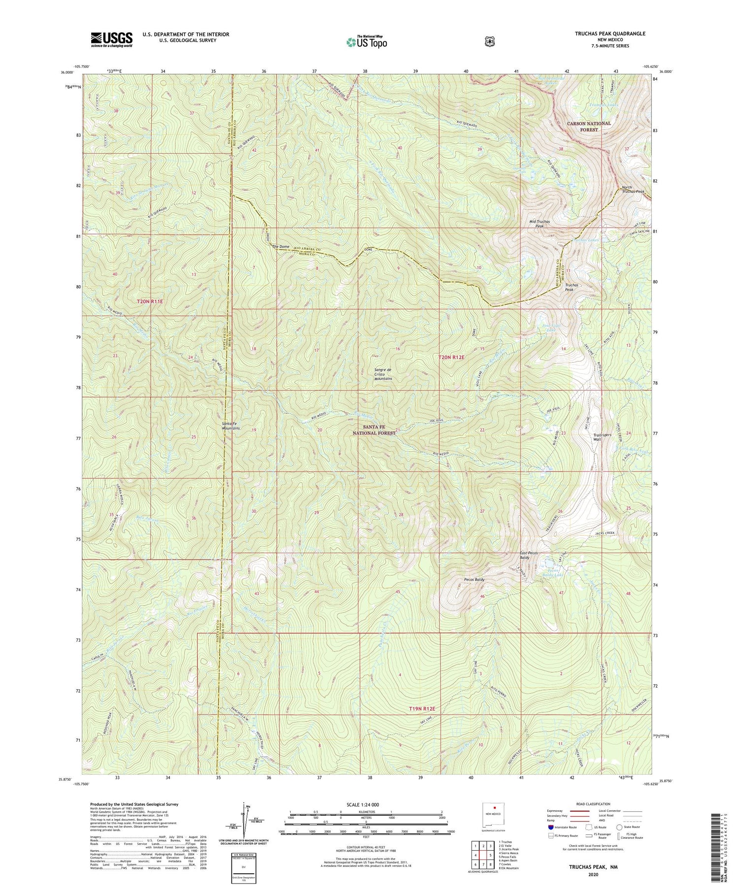
2020 topographic map quadrangle Truchas Peak in the state of New Mexico. Scale: 1:24000. Based on the newly updated USGS 7.5' US Topo map series, this map is in the following counties: Mora, Santa Fe, Rio Arriba. The map contains contour data, water features, and other items you are used to seeing on USGS maps, but also has updated roads and other features. This is the next generation of topographic maps. Printed on high-quality waterproof paper with UV fade-resistant inks.
Quads adjacent to this one:
West: Sierra Mosca
Northwest: Truchas
North: El Valle
Northeast: Jicarita Peak
East: Pecos Falls
Southeast: Elk Mountain
South: Cowles
Southwest: Aspen Basin
Contains the following named places: Brazos Cabin, East Pecos Baldy, Horsethief Meadow, Jose Vigil Lake, Middle Truchas Peak, North Truchas Peak, Panchuela West Cabin, Pecos Baldy, Pecos Baldy Lake, Pecos Wilderness, Rio Medio Trail, Rio Quemado Falls, Rito Canejo, Rito Jaroso, The Dome, Trailriders Wall, Trampas Lakes, Truchas Lakes, Truchas Peak


