MyTopo
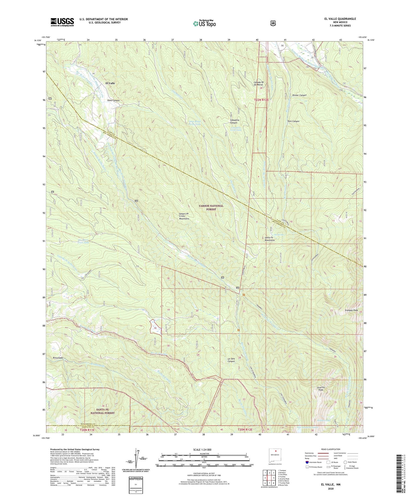
El Valle New Mexico US Topo Map
Couldn't load pickup availability
Also explore the El Valle Forest Service Topo of this same quad for updated USFS data
2023 topographic map quadrangle El Valle in the state of New Mexico. Scale: 1:24000. Based on the newly updated USGS 7.5' US Topo map series, this map is in the following counties: Rio Arriba, Taos, Santa Fe. The map contains contour data, water features, and other items you are used to seeing on USGS maps, but also has updated roads and other features. This is the next generation of topographic maps. Printed on high-quality waterproof paper with UV fade-resistant inks.
Quads adjacent to this one:
West: Truchas
Northwest: Trampas
North: Penasco
Northeast: Tres Ritos
East: Jicarita Peak
Southeast: Pecos Falls
South: Truchas Peak
Southwest: Sierra Mosca
This map covers the same area as the classic USGS quad with code o36105a6.
Contains the following named places: Acequia de Abajo de el Valle, Acequia de Ojo Sarco, Acequia del Llano de San Miguel, Canada de Ojo del Agua, Cebadilla Trick Tank, Chimayo Division, Diamante Tract, Dinner Canyon, El Valle, El Valle Post Office, El Valle Tract, Hidden Lake, Hodges, Hodges Post Office, Jicarilla Peak, Las Trampas Grant, Martinez Ranch, North Fork Rio Quemado, Ojo del Oso, Ojo Sarco Trick Tank, Osha Canyon, Osha Cienaga, Osha Ridge Trick Tank, Rinconada, Rio de la Cebolla, Rio San Leonardo, Saint Michael Church, San Leonardo Lakes, Santa Barbara Campground, South Fork Rio Quemado, Tafoya Ranch, Tent Canyon, Trampas Diamante Campground, Trampas Medio Campground, Trampas Peak, Trampas Trail, Trampas Trailhead Campground, Vallecitos, ZIP Code: 87543