MyTopo
Cowles New Mexico US Topo Map
Couldn't load pickup availability
Also explore the Cowles Forest Service Topo of this same quad for updated USFS data
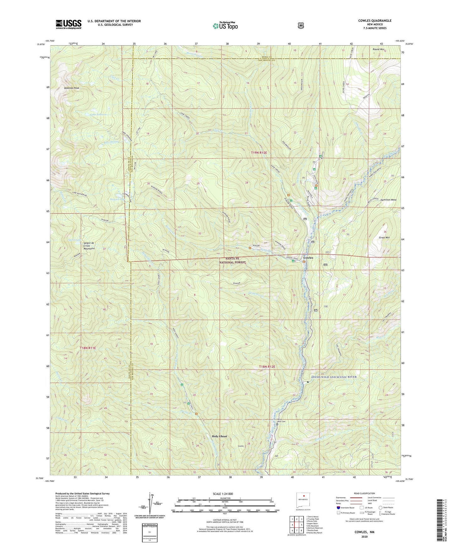
2023 topographic map quadrangle Cowles in the state of New Mexico. Scale: 1:24000. Based on the newly updated USGS 7.5' US Topo map series, this map is in the following counties: San Miguel, Santa Fe, Mora. The map contains contour data, water features, and other items you are used to seeing on USGS maps, but also has updated roads and other features. This is the next generation of topographic maps. Printed on high-quality waterproof paper with UV fade-resistant inks.
Quads adjacent to this one:
West: Aspen Basin
Northwest: Sierra Mosca
North: Truchas Peak
Northeast: Pecos Falls
East: Elk Mountain
Southeast: Honey Boy Ranch
South: Rosilla Peak
Southwest: McClure Reservoir
This map covers the same area as the classic USGS quad with code o35105g6.
Contains the following named places: Albright Creek, Bear Creek, Carpenter Creek, Cave Creek, Connells Cabin Historic Site, Cowles, Cowles Campground, Cowles Post Office, Cowles Weather Station, Doctor Creek, Geronimo, Grass Mountain, Grass Mountain Summer Home Area, Holy Ghost, Holy Ghost Campground, Horsethief Creek, Jacks Creek, Jacks Creek Campground, Lake Johnson, Mora Campground, Panchuela Campground, Panchuela Creek, Panchuela Ranger Station, Pecos Mine, Pecos Mine Cemetery, Redondo Peak, Rio Mora, Rito Oscuro, Rito Perro, Round Mountain, Spirit Lake, Stewart Lake, Tererro Post Office, Willow Creek, Willow Creek Campground, Winsor Creek, Winsor Creek Recreation Site, Winsor Creek Summer Home, ZIP Code: 87573