MyTopo
Variadero New Mexico US Topo Map
Couldn't load pickup availability
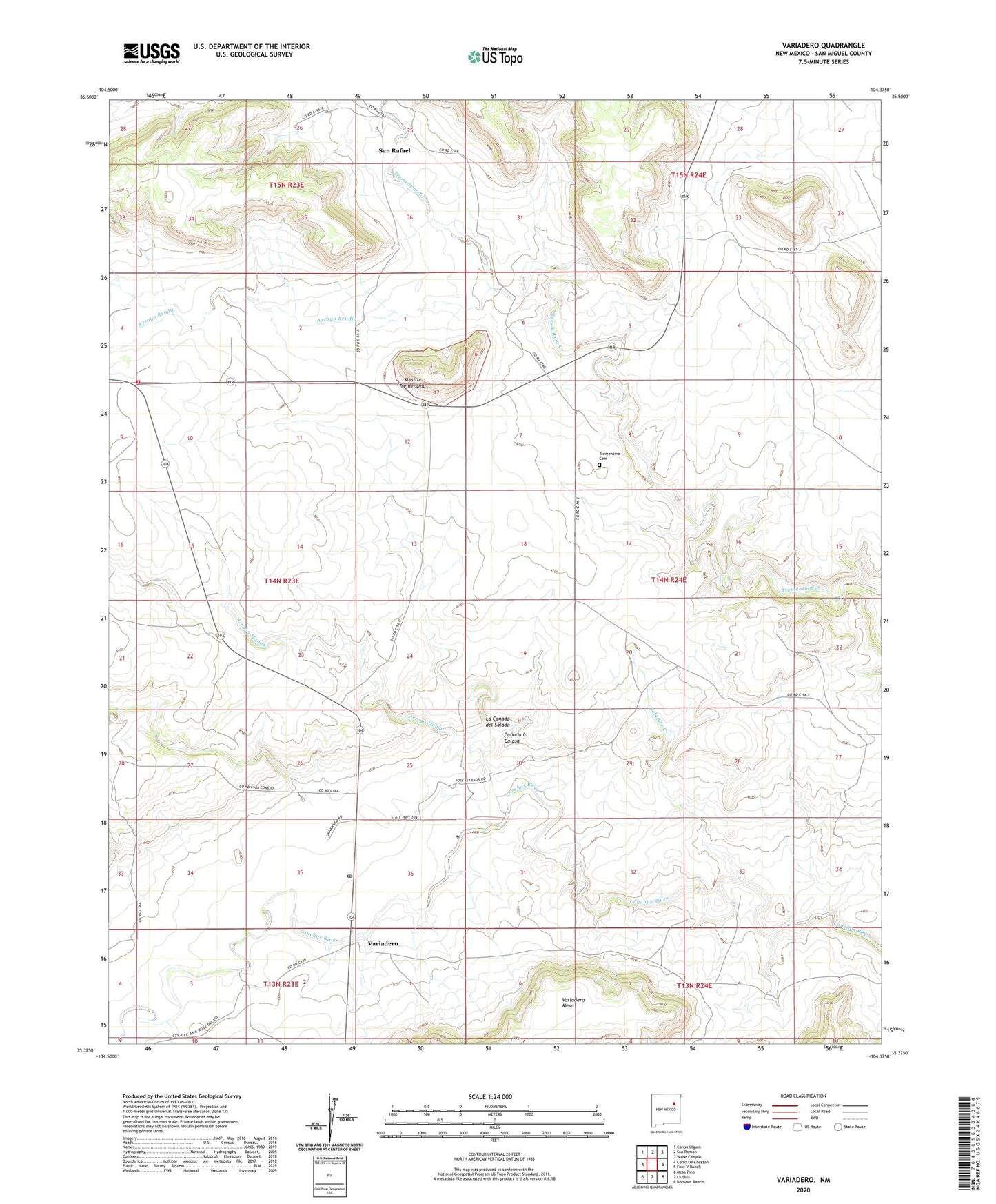
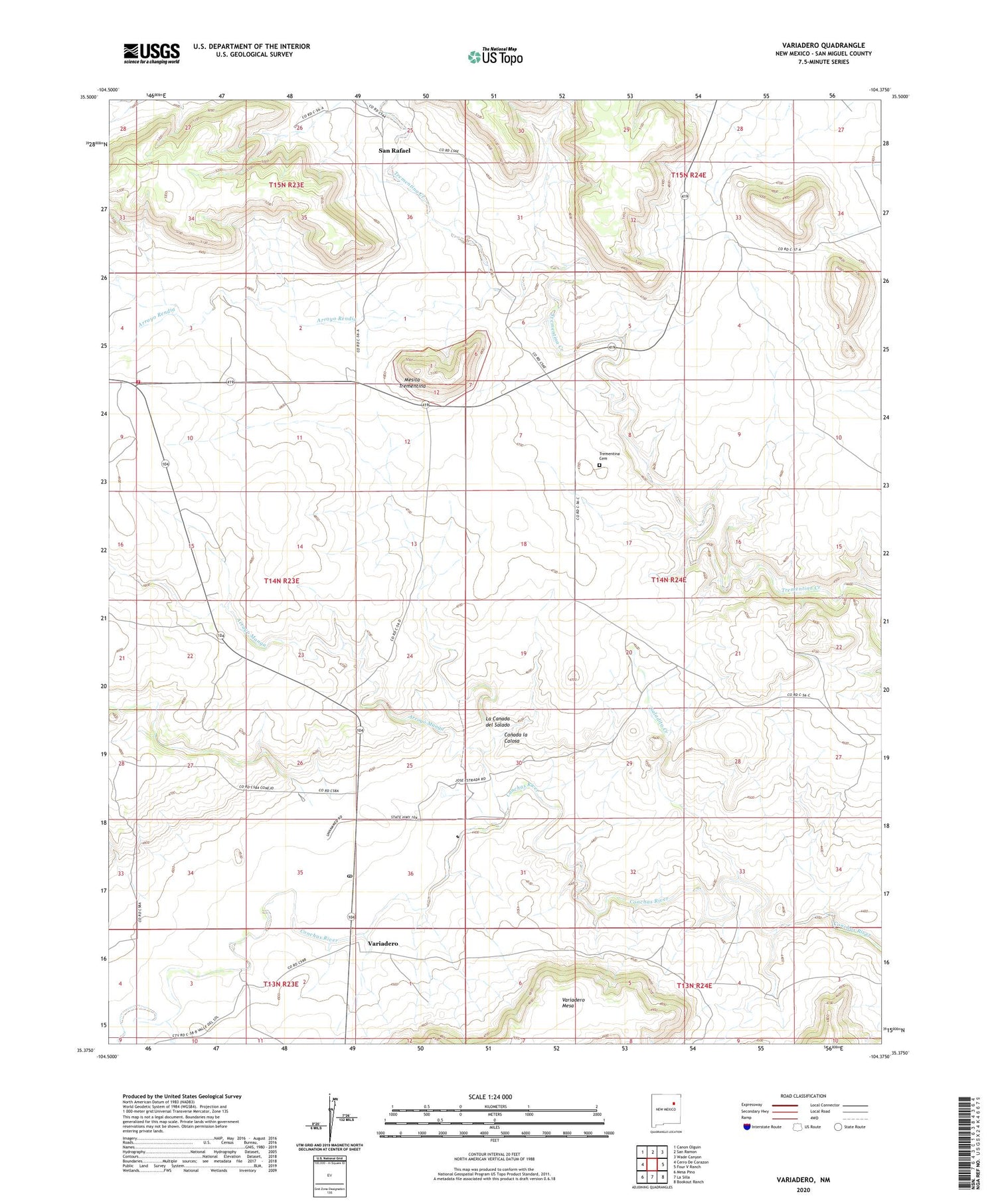
2020 topographic map quadrangle Variadero in the state of New Mexico. Scale: 1:24000. Based on the newly updated USGS 7.5' US Topo map series, this map is in the following counties: San Miguel. The map contains contour data, water features, and other items you are used to seeing on USGS maps, but also has updated roads and other features. This is the next generation of topographic maps. Printed on high-quality waterproof paper with UV fade-resistant inks.
Quads adjacent to this one:
West: Cerro De Corazon
Northwest: Canon Olguin
North: San Ramon
Northeast: Wade Canyon
East: Four V Ranch
Southeast: Bookout Ranch
South: La Silla
Southwest: Mesa Pino
Contains the following named places: Arroyo Hondo, Arroyo Manga, Arroyo Rendia, Canada la Calosa, Garita Post Office, Gonzales, La Canada del Salado, Mesita Trementina, New Trementina, Nick, Saladito Creek, San Miguel County Fire District Trementina Fire Department, San Rafael, San Rafael Church, Trementina Cemetery, Trementina School, Variadero