MyTopo
Yellow Hill New Mexico US Topo Map
Couldn't load pickup availability
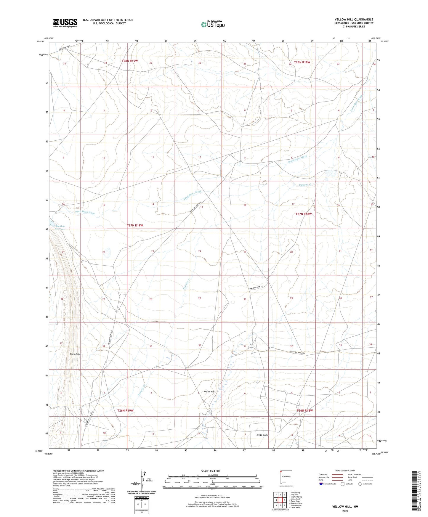
2023 topographic map quadrangle Yellow Hill in the state of New Mexico. Scale: 1:24000. Based on the newly updated USGS 7.5' US Topo map series, this map is in the following counties: San Juan. The map contains contour data, water features, and other items you are used to seeing on USGS maps, but also has updated roads and other features. This is the next generation of topographic maps. Printed on high-quality waterproof paper with UV fade-resistant inks.
Quads adjacent to this one:
West: Mitten Rock
Northwest: Sand Spring
North: Ship Rock
Northeast: Sulphur Spring
East: Table Mesa
Southeast: Little Water
South: Sanostee East
Southwest: Sanostee West
This map covers the same area as the classic USGS quad with code o36108e7.
Contains the following named places: 12R-100 Water Well, 12T-343 Water Well, 12T-508 Water Well, 12T-646 Water Well, 12T-654 Water Well, Big Gap Dam, Big Gap Reservoir, Pajarito Creek, Rock Ridge, Shiprock-Sanostee Division, SJ-743 Water Well, Table Mesa Dam, Tocito Dome, Yellow Hill