MyTopo
Blue Mountain Lake New York US Topo Map
Couldn't load pickup availability
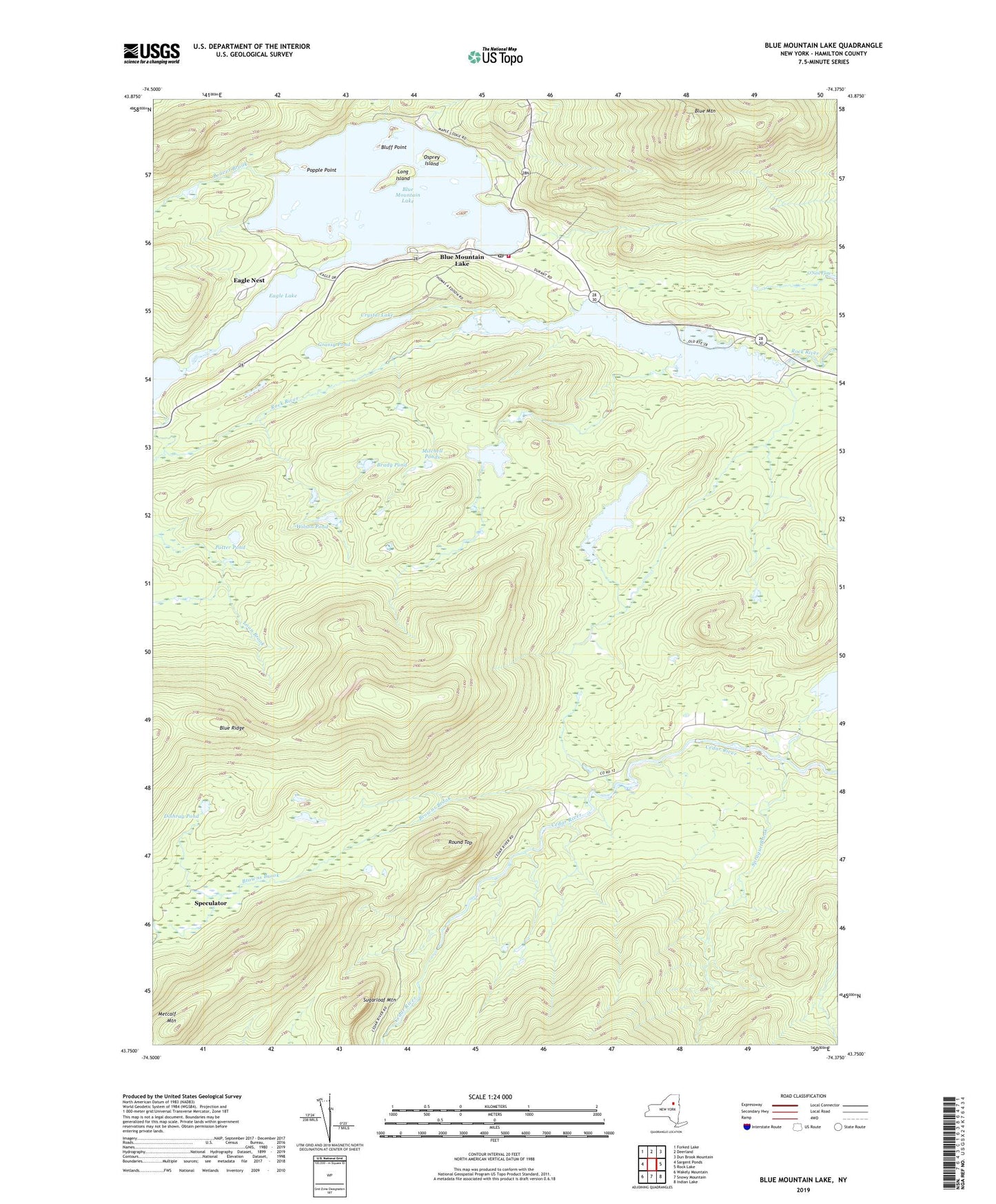
2019 topographic map quadrangle Blue Mountain Lake in the state of New York. Scale: 1:24000. Based on the newly updated USGS 7.5' US Topo map series, this map is in the following counties: Hamilton. The map contains contour data, water features, and other items you are used to seeing on USGS maps, but also has updated roads and other features. This is the next generation of topographic maps. Printed on high-quality waterproof paper with UV fade-resistant inks.
Quads adjacent to this one:
West: Sargent Ponds
Northwest: Forked Lake
North: Deerland
Northeast: Dun Brook Mountain
East: Rock Lake
Southeast: Indian Lake
South: Snowy Mountain
Southwest: Wakely Mountain
Contains the following named places: Adirondack Museum, Beaver Brook, Blue Mountain, Blue Mountain Lake, Blue Mountain Lake Post Office, Blue Mountain Lake Volunteer Fire Department, Blue Ridge, Bluff Point, Brady Pond, Browns Brook, Cascade Pond, Crystal Lake, Dishrag Pond, Eagle Lake, Eagle Nest, Eagle Nest Seaplane Base, Grassy Pond, Lake Durant, Lake Durant Camp, Long Island, Long Pond, Metcalf Mountain, Mitchell Ponds, Northville Lake Placid Trail, Osprey Island, Popple Point, Potter Pond, Rock Pond, Round Top, Slim Pond, Sprague Brook, Sprague Pond, Stephens Pond, Sugarloaf Mountain, Wilson Pond