MyTopo
Indian Lake New York US Topo Map
Couldn't load pickup availability
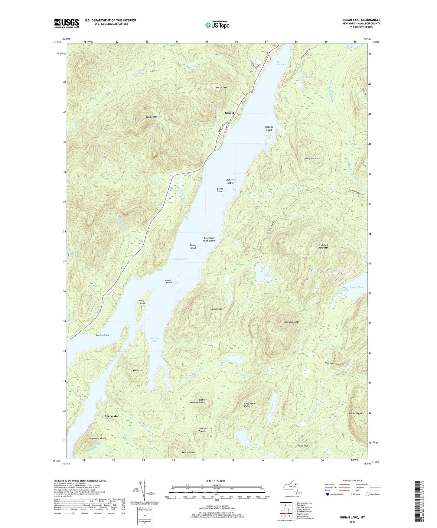
2023 topographic map quadrangle Indian Lake in the state of New York. Scale: 1:24000. Based on the newly updated USGS 7.5' US Topo map series, this map is in the following counties: Hamilton. The map contains contour data, water features, and other items you are used to seeing on USGS maps, but also has updated roads and other features. This is the next generation of topographic maps. Printed on high-quality waterproof paper with UV fade-resistant inks.
Quads adjacent to this one:
West: Snowy Mountain
Northwest: Blue Mountain Lake
North: Rock Lake
Northeast: Bad Luck Mountain
East: Bullhead Mountain
Southeast: South Pond Mountain
South: Kunjamuk River
Southwest: Page Mountain
This map covers the same area as the classic USGS quad with code k43074f3.
Contains the following named places: Baldface Mountain, Beaver Brook, Camp Island, Crotched Pond, Crotched Pond Island, Crotched Pond Mountain, Doherty Brook, Doherty Island, Driftwood Mountain, Forks Brook, Gates Hill, Green Island, Griffin Brook, Hemlock Cobble, Indian Lake, Jerry Pond, John Mack Bay, John Mack Brook, John Mack Pond, Kirpens Island, Kunjamuk Mountain, Little Hardwood Hill, Long Island, Long Pond, Long Pond Ridge, Lowrence Brook, McGinn Brook, Moose Island, Moose Mountain, Petes Hill, Pine Peak, Poplar Point, Porter Mountain, Rock Pond, Round Pond, Sabael, Sabael Post Office, Squaw Brook, Squaw Mountain, The Narrows, Windfall Hill, Woodland Brook, ZIP Codes: 12842, 12864