MyTopo
Wakely Mountain New York US Topo Map
Couldn't load pickup availability
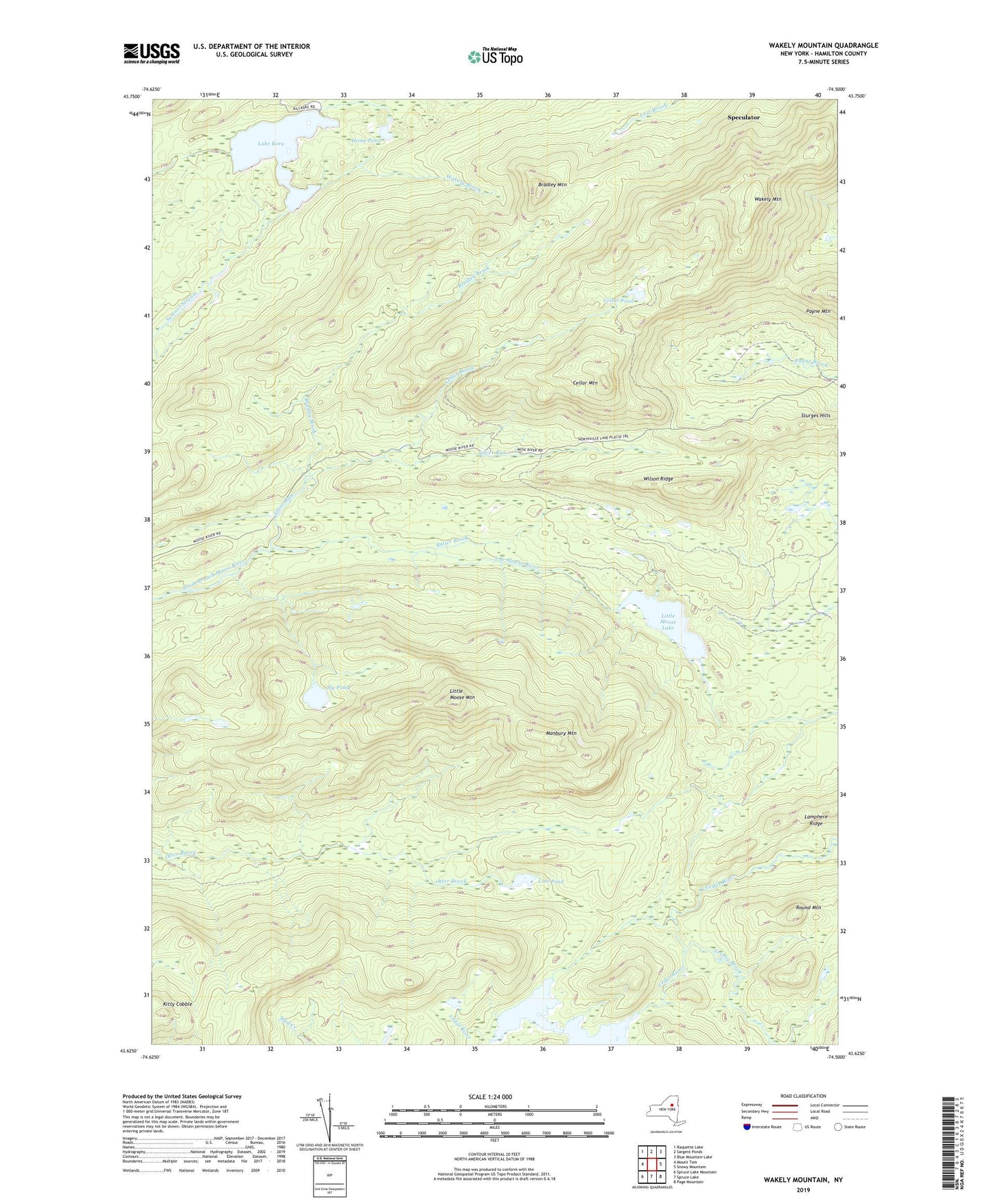
2023 topographic map quadrangle Wakely Mountain in the state of New York. Scale: 1:24000. Based on the newly updated USGS 7.5' US Topo map series, this map is in the following counties: Hamilton. The map contains contour data, water features, and other items you are used to seeing on USGS maps, but also has updated roads and other features. This is the next generation of topographic maps. Printed on high-quality waterproof paper with UV fade-resistant inks.
Quads adjacent to this one:
West: Mount Tom
Northwest: Raquette Lake
North: Sargent Ponds
Northeast: Blue Mountain Lake
East: Snowy Mountain
Southeast: Page Mountain
South: Spruce Lake
Southwest: Spruce Lake Mountain
This map covers the same area as the classic USGS quad with code k43074f5.
Contains the following named places: Beaver Pond, Bradley Brook, Bradley Mountain, Butter Brook, Cellar Brook, Cellar Mountain, Cellar Pond, Grassy Brook, Home Pond, Kamp Kill Kare, Kitty Cobble, Lake Kora, Lamphere Ridge, Little Moose Lake, Little Moose Mountain, Lost Pond, Manbury Mountain, Round Mountain, Silver Run, Sly Pond, Wakely Brook, Wakely Mountain, Wilson Ridge