MyTopo
Borden New York US Topo Map
Couldn't load pickup availability
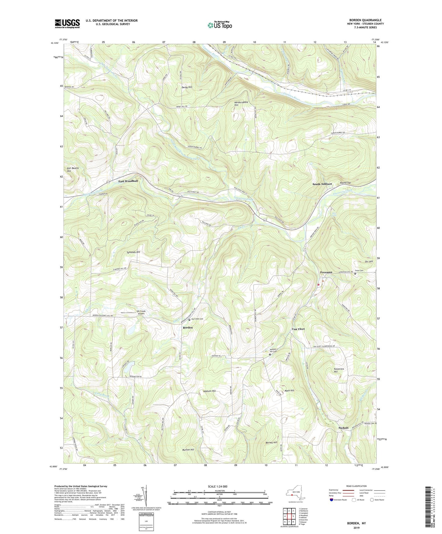
2019 topographic map quadrangle Borden in the state of New York. Scale: 1:24000. Based on the newly updated USGS 7.5' US Topo map series, this map is in the following counties: Steuben. The map contains contour data, water features, and other items you are used to seeing on USGS maps, but also has updated roads and other features. This is the next generation of topographic maps. Printed on high-quality waterproof paper with UV fade-resistant inks.
Quads adjacent to this one:
West: Woodhull
Northwest: Cameron
North: Rathbone
Northeast: Campbell
East: Addison
Southeast: Tioga
South: Elkland
Southwest: Knoxville
Contains the following named places: Addison Hill, Addison Hill Cemetery, Barney Hill, Bear Falls, Borden, Camp Brook School, Canatoga Creek, Catherine Creek, Derby Hill, Derby School, Derby Switch, East Woodhull, Elk Creek, Elk Creek Airport, Elk Creek Cemetery, Fairview School, Freeman, Grace Bible Fellowship, Harder School, Hardscrabble Hill, Helmer School, Hillsprings Farm, Hurd School, Mack Hill, Mack Hill School, Merring School, Mutton Hill, Myers Creek, Nichols, Nichols School, North Branch Tuscarora Creek, Round Top, South Addison, Swan Cemetery, Symonds Hill, Symonds Hill School, Town of Tuscarora, Tuscarora Fire Department, Tuscarora Hill, Van Vleet, Wagon Wheel Mobile Home Park, Williams School, Woods Corner, WYDC-TV (Corning), ZIP Code: 14801