MyTopo
Rathbone New York US Topo Map
Couldn't load pickup availability
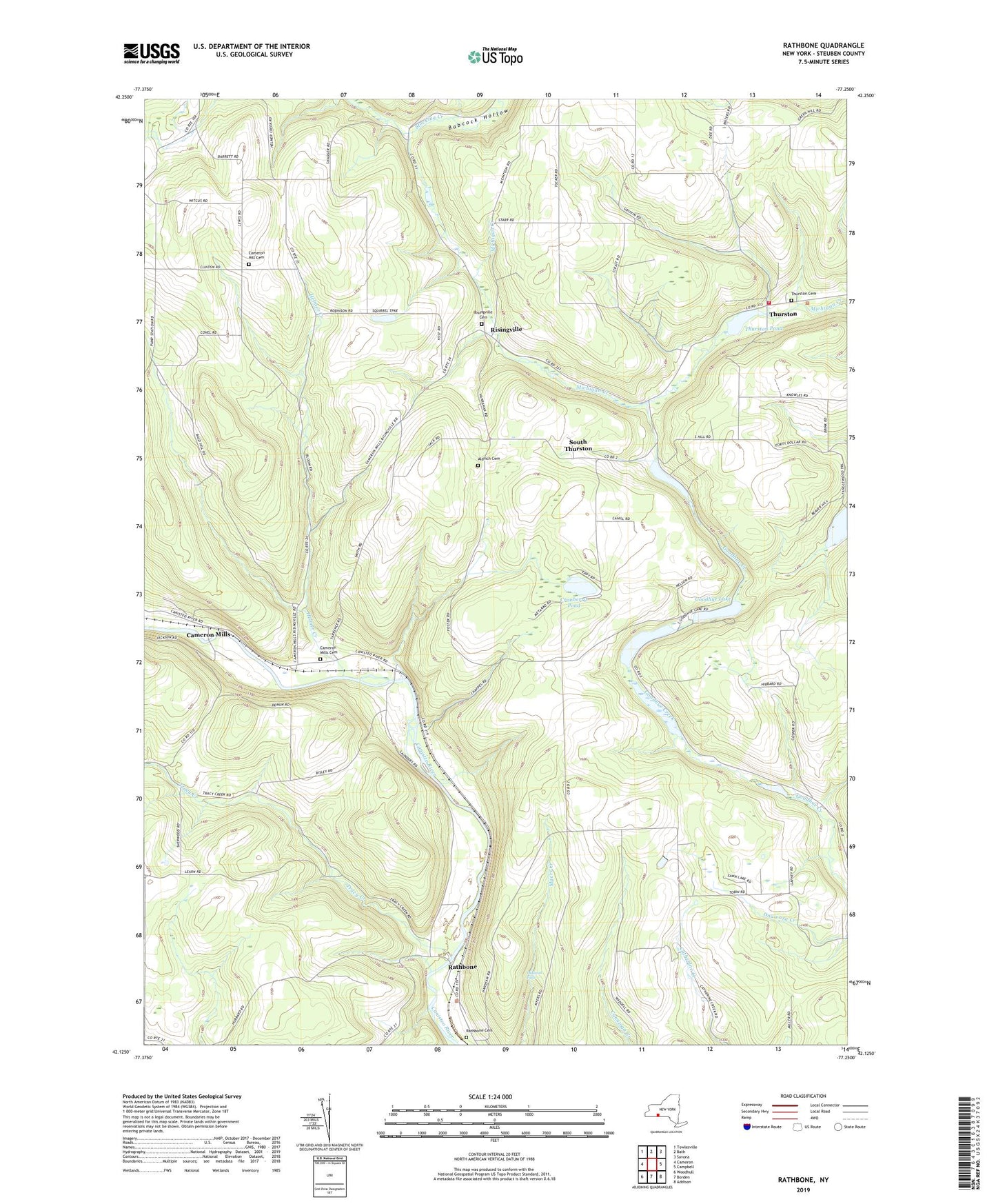
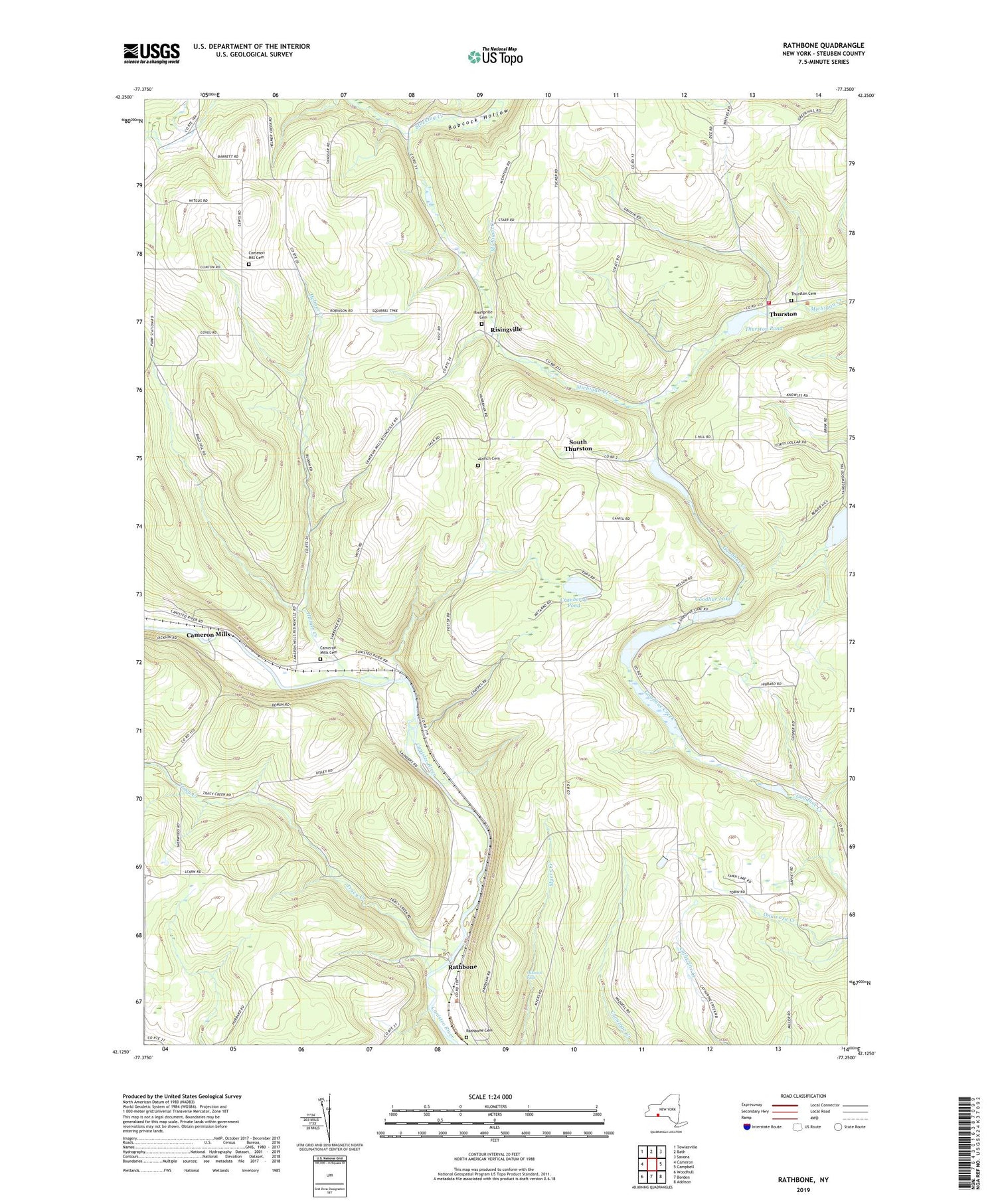
2023 topographic map quadrangle Rathbone in the state of New York. Scale: 1:24000. Based on the newly updated USGS 7.5' US Topo map series, this map is in the following counties: Steuben. The map contains contour data, water features, and other items you are used to seeing on USGS maps, but also has updated roads and other features. This is the next generation of topographic maps. Printed on high-quality waterproof paper with UV fade-resistant inks.
Quads adjacent to this one:
West: Cameron
Northwest: Towlesville
North: Bath
Northeast: Savona
East: Campbell
Southeast: Addison
South: Borden
Southwest: Woodhull
This map covers the same area as the classic USGS quad with code o42077b3.
Contains the following named places: Aldrich Cemetery, Aldrich School, Beaton School, Branch School, Bromley School, Cameron Hill Cemetery, Cameron Hill School, Cameron Mills, Cameron Mills Cemetery, Cranberry Pond, Duck Pond, Goodhue Lake, Helmer Creek, Jones Corners, Oskonsa Falls, Perry School, Phillips School, Rathbone, Rathbone Cemetery, Risingville, Risingville Cemetery, Risingville Methodist Church, Saunders School, Severence School, Shauger School, South Hill School, South Thurston, The Gulf, Thurston, Thurston Cemetery, Thurston Pond, Thurston Volunteer Fire Company, Town Line Church, Town of Rathbone, Town of Thurston, Tracy Creek, Tracy Creek School, Victory Hill Farm, White School, ZIP Code: 14820