MyTopo
Tioga Pennsylvania US Topo Map
Couldn't load pickup availability
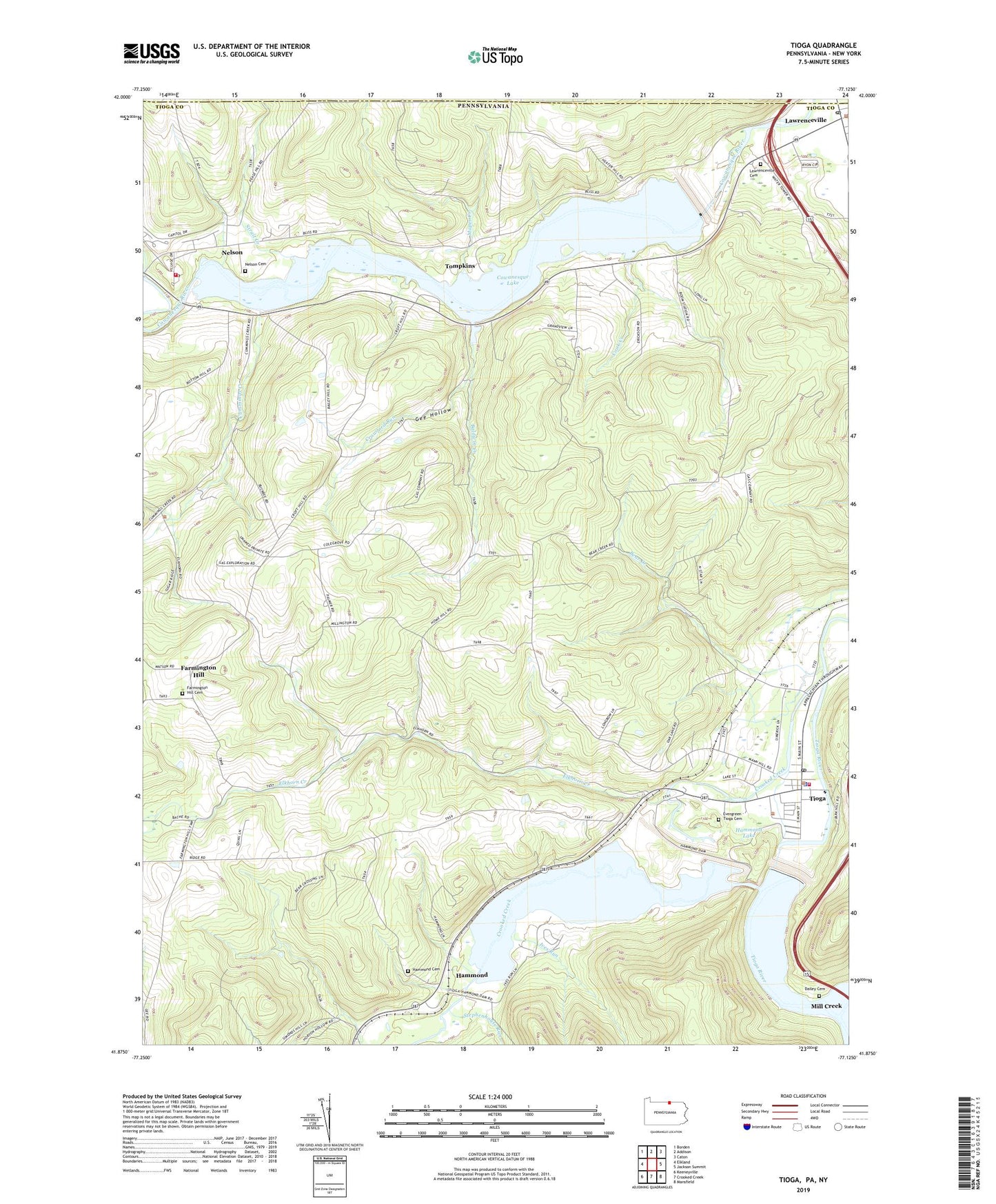
2023 topographic map quadrangle Tioga in the state of Pennsylvania. Scale: 1:24000. Based on the newly updated USGS 7.5' US Topo map series, this map is in the following counties: Tioga, Steuben. The map contains contour data, water features, and other items you are used to seeing on USGS maps, but also has updated roads and other features. This is the next generation of topographic maps. Printed on high-quality waterproof paper with UV fade-resistant inks.
Quads adjacent to this one:
West: Elkland
Northwest: Borden
North: Addison
Northeast: Caton
East: Jackson Summit
Southeast: Mansfield
South: Crooked Creek
Southwest: Keeneyville
This map covers the same area as the classic USGS quad with code o41077h2.
Contains the following named places: Baldwin Creek, Bear Creek, Bill Hess Creek, Boom Pumping Station, Borough of Lawrenceville, Borough of Tioga, Brooklyn, Cook Creek, Cowanesque Dam, Cowanesque Lake, Crawford Run, Crooked Creek, Cummings Creek, Dailey Cemetery, Elkhorn Creek, Evergreen Cemetery, Farmington Hill, Farmington Hill Cemetery, Gee Hollow, H&H Personal Use Airport, Hammond, Hammond Dam, Hammond Lake, Hughes Airport, Ives Run, Lawrenceville, Lawrenceville Borough Police Department, Lawrenceville Cemetery, Lawrenceville Post Office, Mapes Creek, Middlebury Cemetery 3, Mill Creek, Nelson, Nelson Cemetery, Nelson Post Office, Nelson Volunteer Fire Company, Nielsen Airport, Palmer Pumping Station, Pritchard, State Game Lands Number 37, Stephenhouse Run, Strait Creek, Tioga, Tioga Dam, Tioga Fire Department, Tioga Police Department, Tioga Post Office, Tompkins, Tompkins Church, Township of Lawrence, ZIP Codes: 16929, 16940, 16946