MyTopo
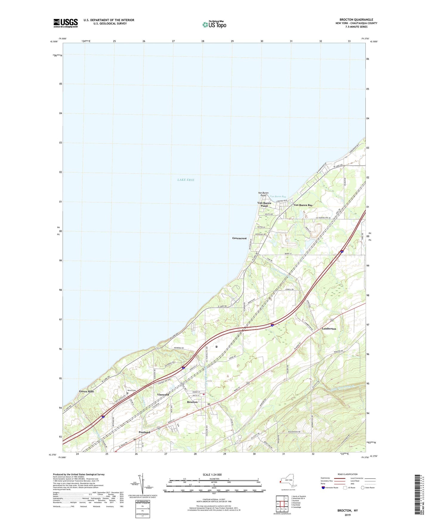
Brocton New York US Topo Map
Couldn't load pickup availability
2019 topographic map quadrangle Brocton in the state of New York. Scale: 1:24000. Based on the newly updated USGS 7.5' US Topo map series, this map is in the following counties: Chautauqua. The map contains contour data, water features, and other items you are used to seeing on USGS maps, but also has updated roads and other features. This is the next generation of topographic maps. Printed on high-quality waterproof paper with UV fade-resistant inks.
Quads adjacent to this one:
West: Westfield OE N
Northeast: North of Dunkirk
East: Dunkirk
Southeast: Cassadaga
South: Hartfield
Southwest: Westfield
Contains the following named places: Ahira Hall Memorial Library, Brocton, Brocton Baptist Church, Brocton Fire Department, Brocton Free Methodist Church, Brocton Post Office, Brocton Village Office, Central School, Corell Creek, Crestview Estates, Ellicott Estates, First Congregational Church, First Methodist Episcopal Church, Free Methodist Church, Green Hills, Greencrest, Johnson's Adult Home, Lake Erie Baptist Church, Lake Erie State Park, Lakeview Shock Incarceration Center Heliport, Lakeview Shock Incarceration Correctional Facility, Lamberton, Little Canadaway Creek, Pecor Cemetery, Portland, Portland Fire Department Station 1, Portland Post Office, Portland Town Hall, Ryckman Park, Saint Patrick's Roman Catholic Church, Seventh Day Adventist Church, Shorewood Country Club, Slippery Rock Creek, Swedish Lutheran Church, Van Buren Bay, Van Buren Drive-In, Van Buren Point, Van Buren School, Village of Brocton, Vineyard, Walker Creek, Waterdogs Farm, ZIP Code: 14716