MyTopo
Hartfield New York US Topo Map
Couldn't load pickup availability
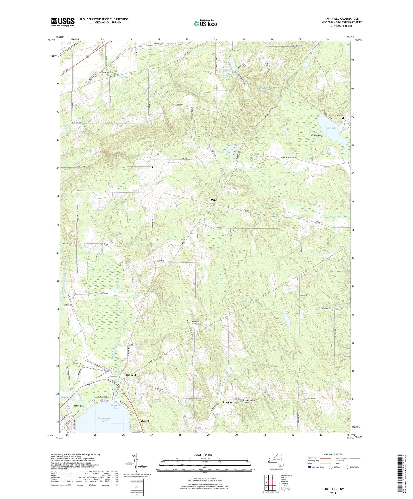
2023 topographic map quadrangle Hartfield in the state of New York. Scale: 1:24000. Based on the newly updated USGS 7.5' US Topo map series, this map is in the following counties: Chautauqua. The map contains contour data, water features, and other items you are used to seeing on USGS maps, but also has updated roads and other features. This is the next generation of topographic maps. Printed on high-quality waterproof paper with UV fade-resistant inks.
Quads adjacent to this one:
West: Westfield
Northwest: Westfield OE N
North: Brocton
Northeast: Dunkirk
East: Cassadaga
Southeast: Ellery Center
South: Chautauqua
Southwest: Sherman
This map covers the same area as the classic USGS quad with code o42079c4.
Contains the following named places: Bear Lake, Big Inlet, Black Creek, Brocton Reservoir, Burdick Road Amish School, Burr Reservoir, Chautauqua County, Chautauqua Lake Airpark, Christian Missionary Alliance Church, Coes Corners, Dart Airport, Dean, Denton Corners, Elm Flats Church, Evergreen Cemetery, Gravel Point, Hartfield, Hartfield Bay, Howard Hill Church, Kelley Cemetery, Little Inlet, Pleasant View School, Pleasantville, Pleasantville Cemetery, Saint Mark Lutheran Church, Skinners Switch, State Reforestation Area, Town of Portland, Triangle Camp, WCQA-FM (Fredonia), Wooglin, ZIP Codes: 14728, 14769, 14784