MyTopo
Brownville New York US Topo Map
Couldn't load pickup availability
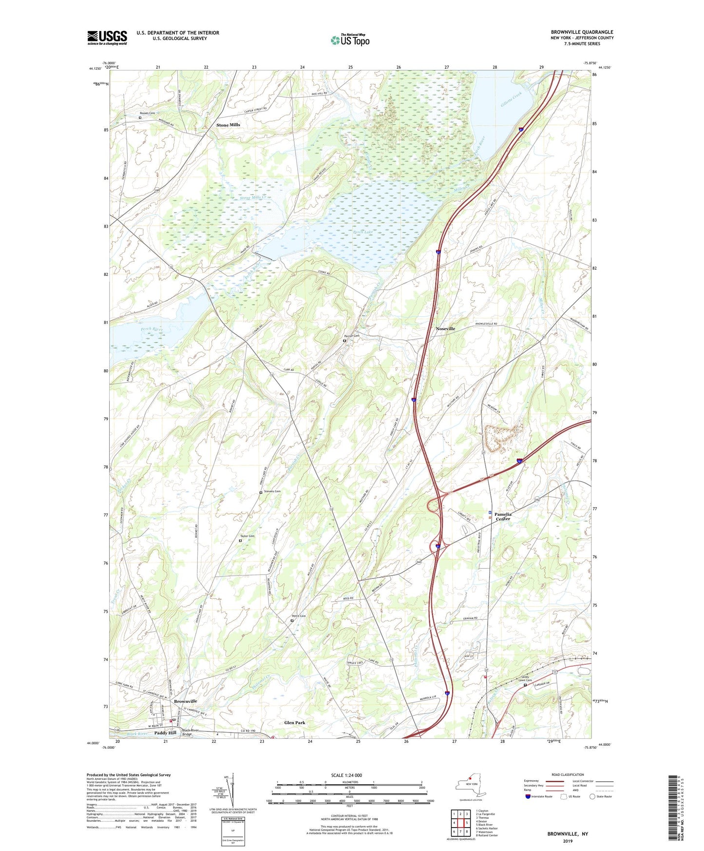
2019 topographic map quadrangle Brownville in the state of New York. Scale: 1:24000. Based on the newly updated USGS 7.5' US Topo map series, this map is in the following counties: Jefferson. The map contains contour data, water features, and other items you are used to seeing on USGS maps, but also has updated roads and other features. This is the next generation of topographic maps. Printed on high-quality waterproof paper with UV fade-resistant inks.
Quads adjacent to this one:
West: Dexter
Northwest: Clayton
North: La Fargeville
Northeast: Theresa
East: Black River
Southeast: Rutland Center
South: Watertown
Southwest: Sackets Harbor
Contains the following named places: Black River Bridge, Brownville, Brownville - Glen Park Library, Brownville Post Office, Brownville School, Brownville Sewage Treatment Plant, Brownville United Methodist Church, Brownville Volunteer Fire Department, Calcium Volunteer Fire Department Station 2, Carter Creek, Gillette Creek, Glen Park, Glen Park Village Fire Department, Gunns Corners, Highland Meadows Golf and Country Club, Jenkins School, Miller Creek, New York State Police Troop D Zone 3 Watertown Station, Northside Drive-In, Noseville, Pamelia Center, Pamelia Center Census Designated Place, Parrish Cemetery, Parrish Creek, Perch Lake, Perch River State Game Management Area, Pettit Cemetery, Philomel Creek, River of Life Fellowship, Rouses Cemetery, Saint Paul's Episcopal Church, Sandy Lawn Cemetery, School Number 1, School Number 2, School Number 3, School Number 4, School Number 6, Scoville Corners, Stevens Cemetery, Stone Mills, Stone Mills Creek, Summit Trailer Park, Taylor Cemetery, Town of Pamelia, Village of Brownville, Village of Glen Park, Willow Creek, Willowbrook Country Club, WTNY-FM (Watertown), ZIP Code: 13615