MyTopo
Rutland Center New York US Topo Map
Couldn't load pickup availability
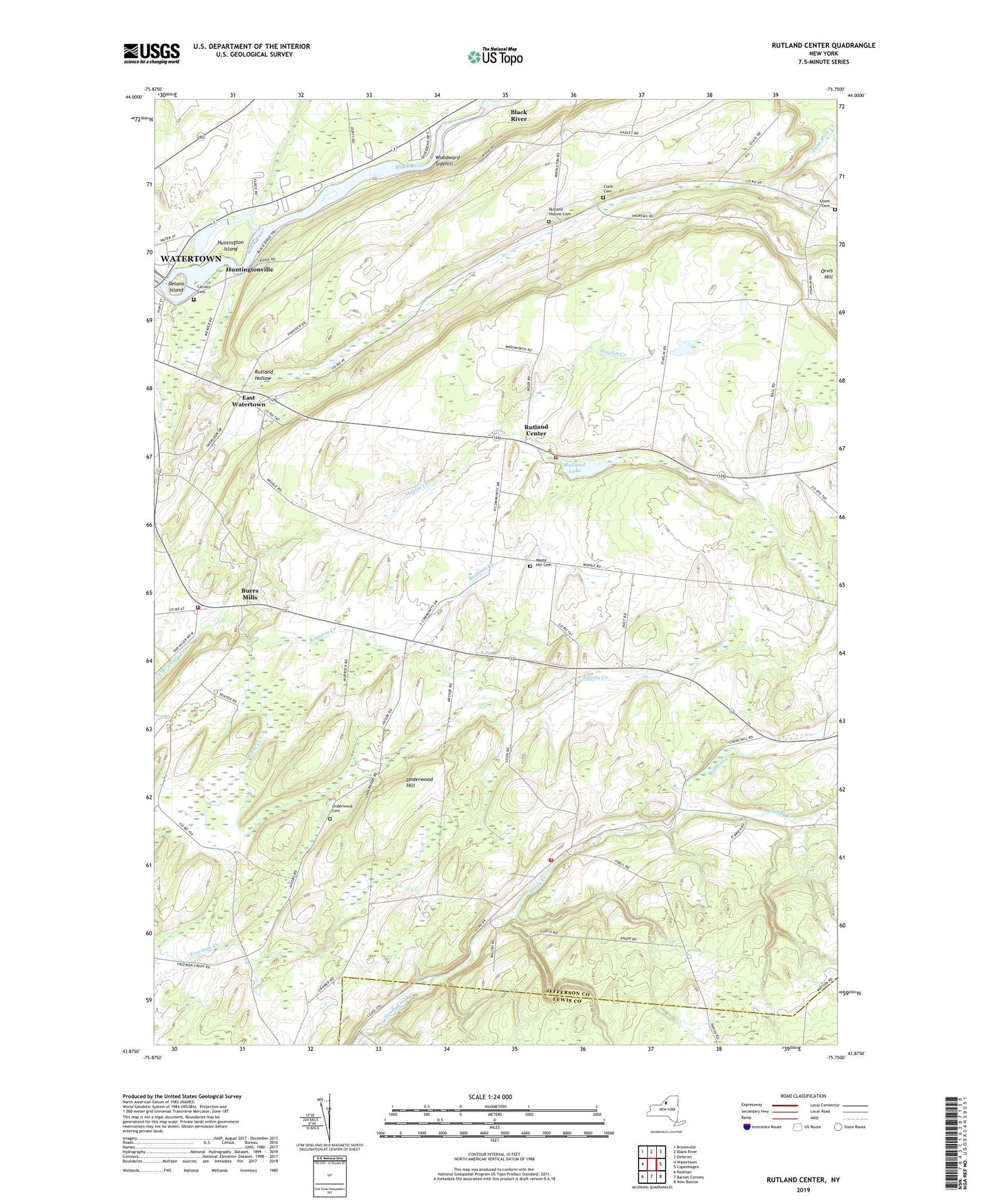
2023 topographic map quadrangle Rutland Center in the state of New York. Scale: 1:24000. Based on the newly updated USGS 7.5' US Topo map series, this map is in the following counties: Jefferson, Lewis. The map contains contour data, water features, and other items you are used to seeing on USGS maps, but also has updated roads and other features. This is the next generation of topographic maps. Printed on high-quality waterproof paper with UV fade-resistant inks.
Quads adjacent to this one:
West: Watertown
Northwest: Brownville
North: Black River
Northeast: Deferiet
East: Copenhagen
Southeast: New Boston
South: Barnes Corners
Southwest: Rodman
This map covers the same area as the classic USGS quad with code o43075h7.
Contains the following named places: Boynton Creek, Burrs Mills, Burrville Cider Mill Falls, Burrville Congregational Church, Butternut Falls, Calvary Cemetery, Christian Life Center, Clark Cemetery, Cotes Cemetery, Delano Island, East Watertown, Harpers Ferry, Harpers Ferry Church, Huntington Island, Huntingtonville, Jacobs Creek, Maple Hill Cemetery, Middle Road Church, New Testament Fellowship, Orvis Hill, Rutland Center, Rutland Fire Department Station 2, Rutland Hollow, Rutland Hollow Cemetery, Rutland Lake, School Number 10, School Number 2, School Number 4, School Number 5, School Number 6, School Number 7, School Number 8, School Number 9, Staplin Creek, Stebbins Creek, Town of Rutland, Tylersville, Underwood Cemetery, Underwood Hill, United Pentecostal Church, Watertown Quarry, Watertown Volunteer Fire Department Station 2, WCIZ-FM (Watertown), Woodward Sidehill, ZIP Code: 13612