MyTopo
Theresa New York US Topo Map
Couldn't load pickup availability
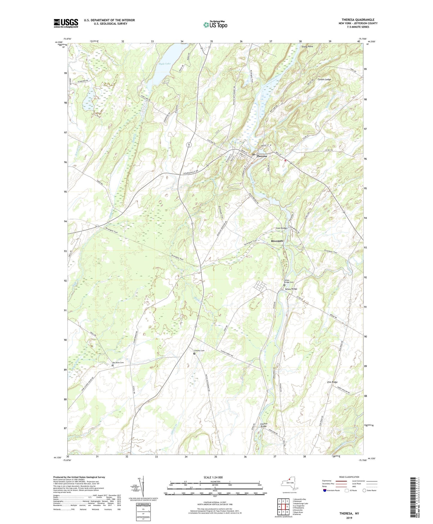
2023 topographic map quadrangle Theresa in the state of New York. Scale: 1:24000. Based on the newly updated USGS 7.5' US Topo map series, this map is in the following counties: Jefferson. The map contains contour data, water features, and other items you are used to seeing on USGS maps, but also has updated roads and other features. This is the next generation of topographic maps. Printed on high-quality waterproof paper with UV fade-resistant inks.
Quads adjacent to this one:
West: La Fargeville
Northwest: Alexandria Bay
North: Redwood
Northeast: Muskellunge Lake
East: Philadelphia
Southeast: Deferiet
South: Black River
Southwest: Brownville
This map covers the same area as the classic USGS quad with code o44075b7.
Contains the following named places: Bacon School, Black Creek, Casey Creek, Chaufty Cemetery, Coon Bridge, Cooper Corners, Corbin Ledge, Douglas Crossing, Elm Ridge, Gospel Mission Fellowship, Home Again Farm, Hyde Lake, Indian River Estates Mobile Home Park, Joachim Bridge, Kelsey Bridge, Kelsey Bridge Cemetery, Martin's Organic Farm, North Jefferson Christian Fellowship, Otter Creek, Rivergate, Saint Theresa of Avila Church, Santway Park, School Number 12, School Number 13, School Number 7, Shurtleff Corners, Soapstone Creek, Still Corners, Stony Point, Stroughs Crossing, Theresa, Theresa Emergency Corps, Theresa Fire Department, Theresa Free Library, Theresa Post Office, Theresa Presbyterian Church, Theresa Primary School, Town of Theresa, Van Allen Cemetery, Village of Theresa, Whitneys Corners, ZIP Code: 13691