MyTopo
Camillus New York US Topo Map
Couldn't load pickup availability
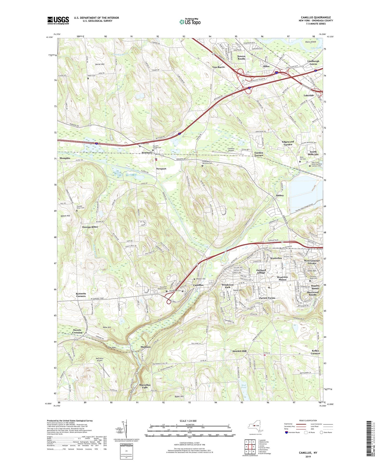
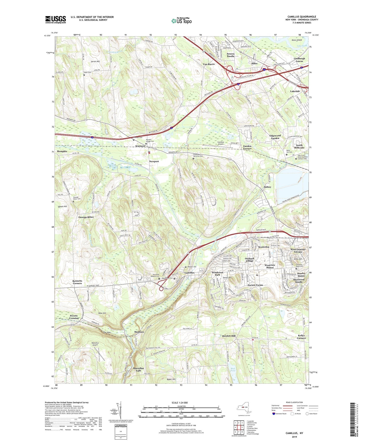
2019 topographic map quadrangle Camillus in the state of New York. Scale: 1:24000. Based on the newly updated USGS 7.5' US Topo map series, this map is in the following counties: Onondaga. The map contains contour data, water features, and other items you are used to seeing on USGS maps, but also has updated roads and other features. This is the next generation of topographic maps. Printed on high-quality waterproof paper with UV fade-resistant inks.
Quads adjacent to this one:
West: Jordan
Northwest: Lysander
North: Baldwinsville
Northeast: Brewerton
East: Syracuse West
Southeast: South Onondaga
South: Marcellus
Southwest: Skaneateles
Contains the following named places: Amboy, Amboy Belle Isle United Church, Amboy Station, Belle Isle Cemetery, Bennetts Corners, Bitter Brook, Camillus, Camillus Airport, Camillus Country Club, Camillus First Baptist Church, Camillus First United Methodist Church, Camillus Middle School, Camillus Park, Camillus Post Office, Christ Community United Methodist Church, Crows Hollow, East Hill Elementary School, Edgecliff Park, Edgewood Garden, Fairmont Rural Cemetery, Fairmount Community Church, Garden Terrace, Gillis Hill, Greenlawn Memorial Park, Holy Cross National Catholic Church, Holy Cross Polish National Catholic Cemetery, Howlett Hill, Howlett Hill Fire Department, Howlett Hill Presbyterian Church, Immanuel United Methodist Church, Kallet Drive-In, Kellys Corners, Klein Island, Lakeside, Lindbergh Lawns, Long Branch Park, Maplewood Cemetery, Marcellus Airport, Marcellus Falls, Martisco, Maxwell Memorial Library, Newport, Nineteenth Pond, North Belle Isle, Nose Hill, Onondaga County Sheriffs Department Heliport, Orchard Village, Oswego Bitter, Oswego Bitter Cemetery, Our Lady of Good Counsel Church, Parson Farms, Pine Grove Country Club, Saint Joseph's Church, Saint Lukes Episcopal Church, Saint Michael's Lutheran Church, Saint Pauls Church, School Number 1, School Number 2, School Number 5, School Number 6, School Number 7, School Number 8, School Number 9, Sears Cemetery, Seneca Knolls, Seneca Knolls Census Designated Place, Sherwood Knolls, Sherwood Robbins Cemetery, Smith Hill, Solvay Middle School, Sorrel Hill, Stanley Manor, State Fair Toll Plaza, Stiles, Stonehedge Elementary School, Sweets Crossing, Syracuse Municipal Airport, Syracuse State School, The Alps, Town of Camillus, Town of Van Buren, Trinity Baptist Church, Tuscarora Golf Club, Van Buren, Village of Camillus, Warners, Warners Cemetery, Warners Fire Department, Warners Post Office, Warners Rest Area, Warners Village Cemetery, West Genesee Hills Baptist Church, West Genesee Middle School, West Genesee Senior High School, West Genesee Terrace, West Hill Golf Course, Westerlea, Western Area Volunteer Emergency Service, Westvale Golf Club, Westview Manor, Wheeler Cemetery, Windcrest Park, ZIP Codes: 13031, 13164