MyTopo
South Onondaga New York US Topo Map
Couldn't load pickup availability
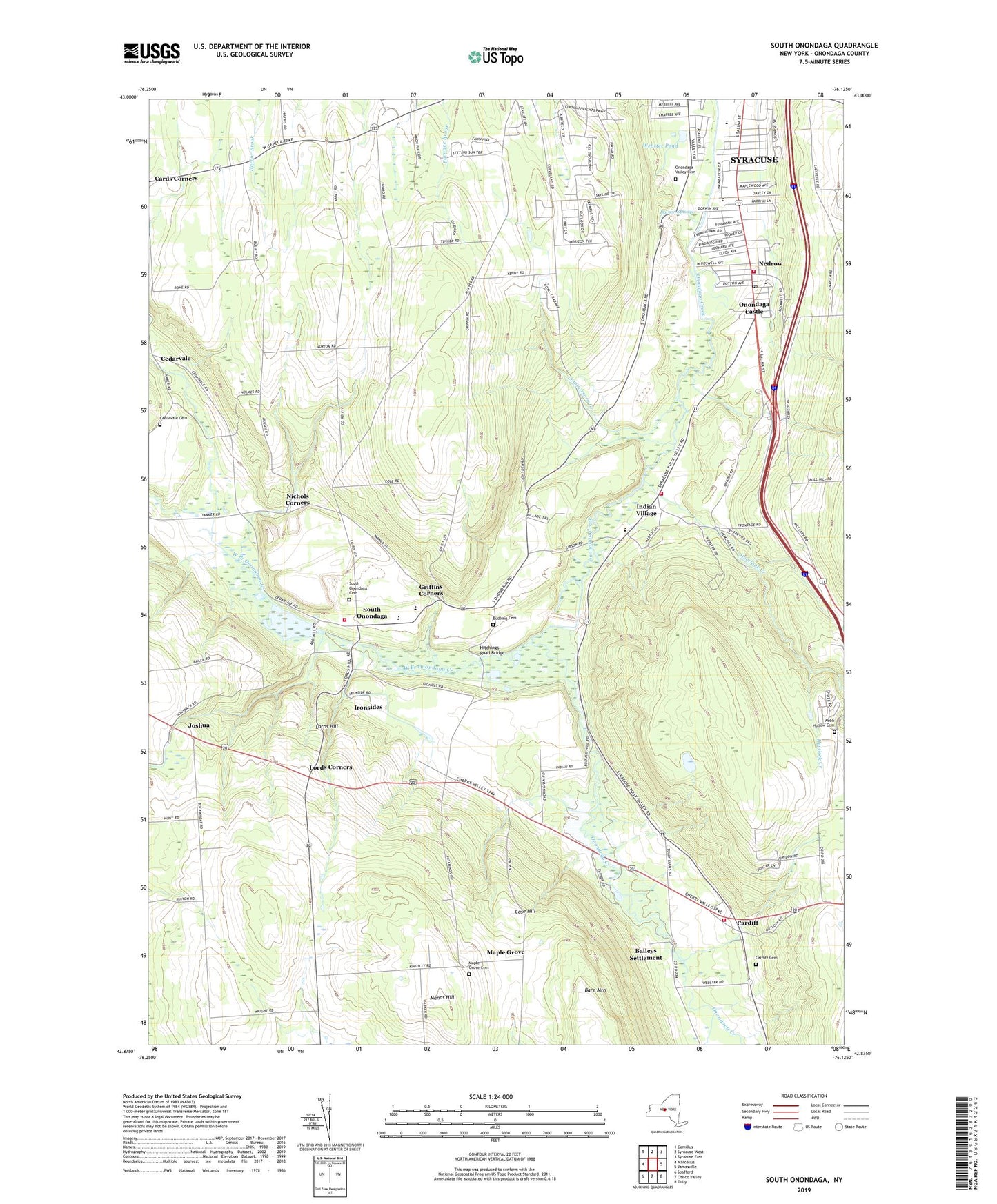
2023 topographic map quadrangle South Onondaga in the state of New York. Scale: 1:24000. Based on the newly updated USGS 7.5' US Topo map series, this map is in the following counties: Onondaga. The map contains contour data, water features, and other items you are used to seeing on USGS maps, but also has updated roads and other features. This is the next generation of topographic maps. Printed on high-quality waterproof paper with UV fade-resistant inks.
Quads adjacent to this one:
West: Marcellus
Northwest: Camillus
North: Syracuse West
Northeast: Syracuse East
East: Jamesville
Southeast: Tully
South: Otisco Valley
Southwest: Spafford
This map covers the same area as the classic USGS quad with code o42076h2.
Contains the following named places: Apple Valley United Methodist Church, Baileys Settlement, Beak And Skiff Apple Farms, Budlong Cemetery, Cardiff, Cardiff Cemetery, Case Hill, Cedarvale, Cedarvale Cemetery, Clary Middle School, Commissary Creek, Dorwin Springs, Full Gospel Church of the Lord, Griffins Corners, Gwills Corners, Hemlock Creek, Hitchings Road Bridge, Holy Tabernacle Church of God, Indian Village, Ironsides, Joshua, Kennedy Creek, Lafayette Assembly of God Church, LaFayette Country Club, LaFayette Fire Department Station 2, Lords Corners, Lords Hill, Manns Hill, Maple Grove, Maple Grove Cemetery, McLusky Orchards, Meachem Elementary School, Nedrow, Nedrow Airpark, Nedrow Census Designated Place, Nedrow Fire Department, Nedrow Post Office, Nichols Corners, O'Neills Orchard, Onondaga Castle, Onondaga County Public Library Betts Branch, Onondaga Creek Flood Control Dam, Onondaga High School, Onondaga Indian School, Onondaga Nation Fire Department, Onondaga Nation Reservation, Onondaga Nation School, Onondaga Valley Cemetery, Onondaga Wesleyan Church, Parc du Bois, Peppermill Gulf, Rockwell Elementary School, Saint Andrew's Anglican Church, Saint James Roman Catholic Church, Saint James School, Saint Paul's United Methodist Church, Salina Drive-In, School Number 11, School Number 12, School Number 2, School Number 5, School Number 6, School Number 9, Smoky Hollow, South Onondaga, South Onondaga Cemetery, South Onondaga Pit, South Onondaga Volunteer Fire Department, State College Experimental Station, Tanner Valley Golf Course, Town of Onondaga, Tully Valley, Turning Point Assembly of God Church, Valley Tabernacle, Webb Hollow, Webb Hollow Cemetery, Webster Pond, West Branch Onondaga Creek, Wheeler Middle School, WMHR-FM (Syracuse), WSYR-AM (Syracuse), WSYT-TV (Syracuse), ZIP Codes: 13120, 13215