MyTopo
Cassville New York US Topo Map
Couldn't load pickup availability
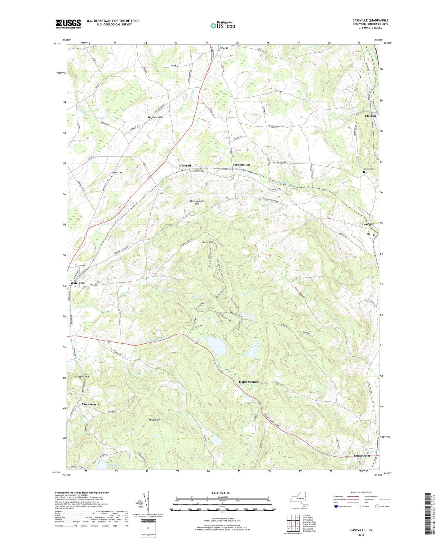
2019 topographic map quadrangle Cassville in the state of New York. Scale: 1:24000. Based on the newly updated USGS 7.5' US Topo map series, this map is in the following counties: Oneida. The map contains contour data, water features, and other items you are used to seeing on USGS maps, but also has updated roads and other features. This is the next generation of topographic maps. Printed on high-quality waterproof paper with UV fade-resistant inks.
Quads adjacent to this one:
West: Oriskany Falls
Northwest: Clinton
North: Utica West
Northeast: Utica East
East: West Winfield
Southeast: Unadilla Forks
South: Brookfield
Southwest: Hubbardsville
Contains the following named places: Bailey Lake, Bridgewater, Bridgewater Census Designated Place, Bridgewater Post Office, Bridgewater Volunteer Fire Company, Budlong Cemetery, Cassville, Cassville Baptist Church, Cassville Fire Department, Cassville Post Office, Clayville, Cragfoot Hill, Daytonville, Doolittle School, Eastman Cemetery, Fitchs Mobile Home Park, Five Corners, Greens Crossing, Hardscrabble Hill, Hobin Corners, Hubbard Corners, Kingdom Hall of Jehovahs Witnesses, Lewis Corners, Mapledale, Marshall, McConnell Corners, Memorial Park Elementary School, Mount Hunger, Paris Station, Peck Corners, Reach Out Family Worship Center, Saint Bernard's Church, Saint Bernard's Roman Catholic Church, Sauquoit Valley School, Sheepskin Hollow, Sulphur Springs Golf Course, Tassel Hill, Tophet School, Town of Bridgewater, Town of Paris, Village of Bridgewater, Waterville Area Volunteer Ambulance Corps, ZIP Codes: 13313, 13318, 13480