MyTopo
Unadilla Forks New York US Topo Map
Couldn't load pickup availability
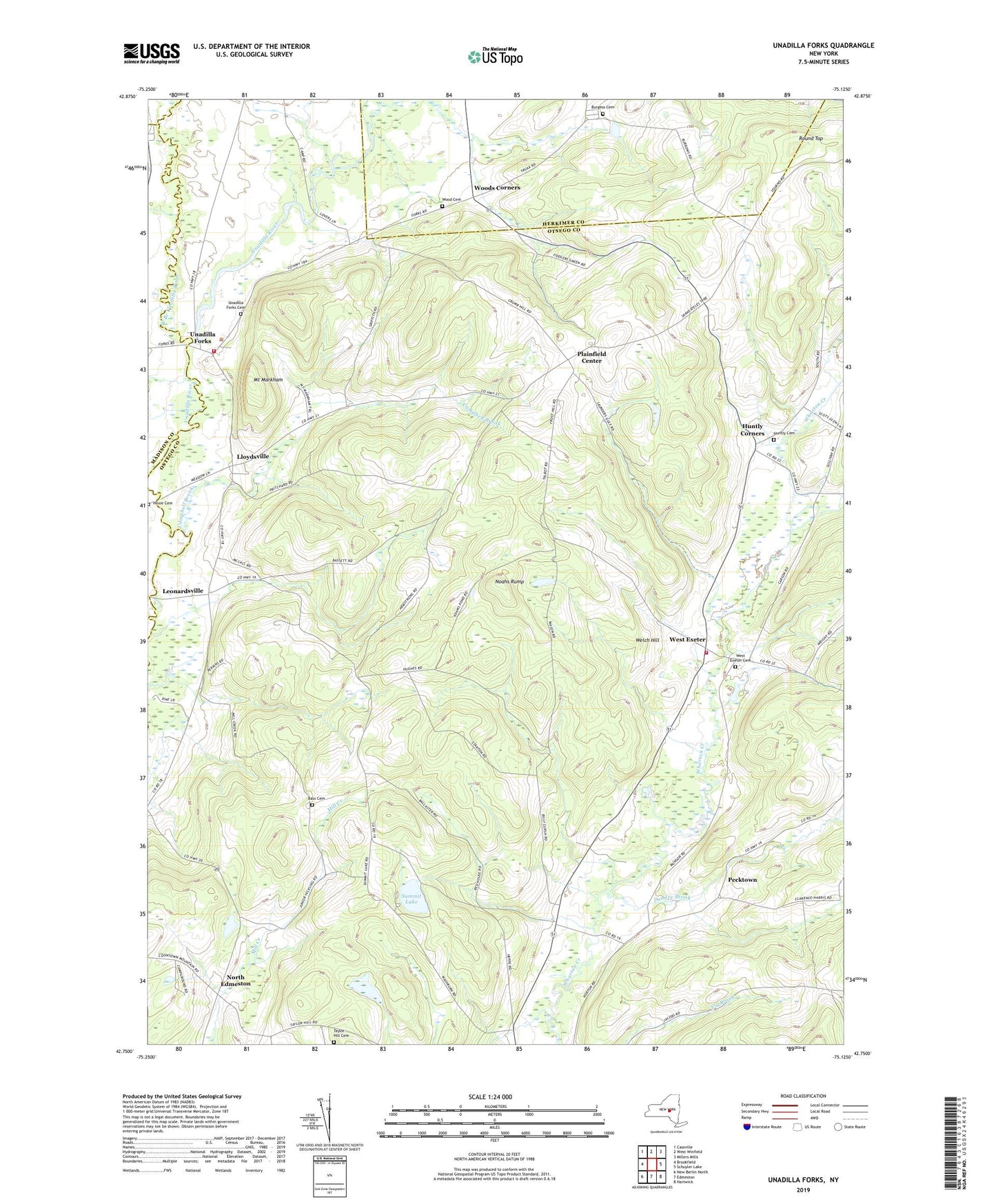
2023 topographic map quadrangle Unadilla Forks in the state of New York. Scale: 1:24000. Based on the newly updated USGS 7.5' US Topo map series, this map is in the following counties: Otsego, Herkimer, Madison, Oneida. The map contains contour data, water features, and other items you are used to seeing on USGS maps, but also has updated roads and other features. This is the next generation of topographic maps. Printed on high-quality waterproof paper with UV fade-resistant inks.
Quads adjacent to this one:
West: Brookfield
Northwest: Cassville
North: West Winfield
Northeast: Millers Mills
East: Schuyler Lake
Southeast: Hartwick
South: Edmeston
Southwest: New Berlin North
This map covers the same area as the classic USGS quad with code o42075g2.
Contains the following named places: Bass Cemetery, Beverly Inn Corners, Burgess Cemetery, Campbell Brook, Dundee Brook, Hoxie Cemetery, Huntly Cemetery, Huntly Corners, Lloydsville, Mount Markham, Noahs Rump, North Edmeston, Pecktown, Plainfield Center, River Forks, Round Top, School Number 8, Spooner Corners, Stonegate Country Club at Summit Lakes, Summit Lake, Taylor Hill Cemetery, TGP-245 Heliport, Town of Plainfield, Unadilla Forks, Unadilla Forks Cemetery, Unadilla Forks Census Designated Place, Unadilla Forks Volunteer Fire Company, Welch Hill, West Branch Unadilla River, West Exeter, West Exeter Cemetery, West Exeter Fire Department, Wood Cemetery, Woods Corners, ZIP Code: 13491