MyTopo
Cincinnatus New York US Topo Map
Couldn't load pickup availability
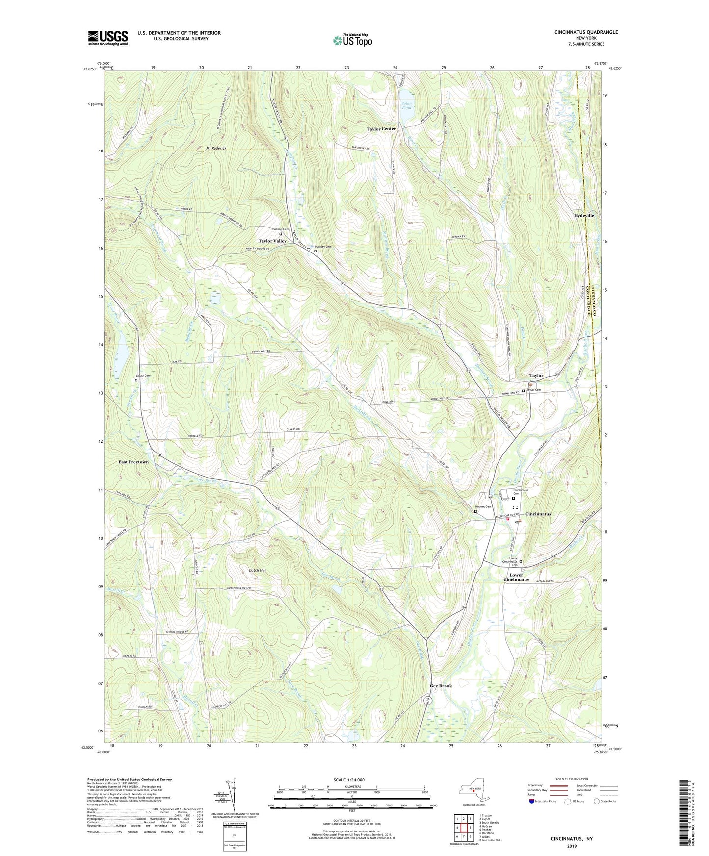
2019 topographic map quadrangle Cincinnatus in the state of New York. Scale: 1:24000. Based on the newly updated USGS 7.5' US Topo map series, this map is in the following counties: Cortland, Chenango. The map contains contour data, water features, and other items you are used to seeing on USGS maps, but also has updated roads and other features. This is the next generation of topographic maps. Printed on high-quality waterproof paper with UV fade-resistant inks.
Quads adjacent to this one:
West: McGraw
Northwest: Truxton
North: Cuyler
Northeast: South Otselic
East: Pitcher
Southeast: Smithville Flats
South: Willet
Southwest: Marathon
Contains the following named places: Brakel Creek, Cincinnatus, Cincinnatus Cemetery, Cincinnatus Elementary School, Cincinnatus High School, Cincinnatus Middle School, Cincinnatus Post Office, Cincinnatus Volunteer Fire Department, Dutch Hill, East Freetown, First Baptist Church, Fish School, Gee Brook, Hawley Cemetery, Holland Cemetery, Holmes Cemetery, Hydeville, Kellogg Free Library, Knickerbocker Country Club, Loope Cemetery, Lower Cincinnatus, Lower Cincinnatus Cemetery, Mallory Brook, Mead Brook, Minard School, Mount Roderick, Mudge School, Our Lady of Perpetual Help Church, Pond Creek, School Number 2, School Number 6, School Number 7, Solon Pond, Solon Pond School, Taylor, Taylor Cemetery, Taylor Center, Taylor Valley, Taylor Wesleyan Church, Town of Cincinnatus, Town of Taylor, United Presbyterian Church, Wells Creek, West Hill School, Wood School, ZIP Code: 13040