MyTopo
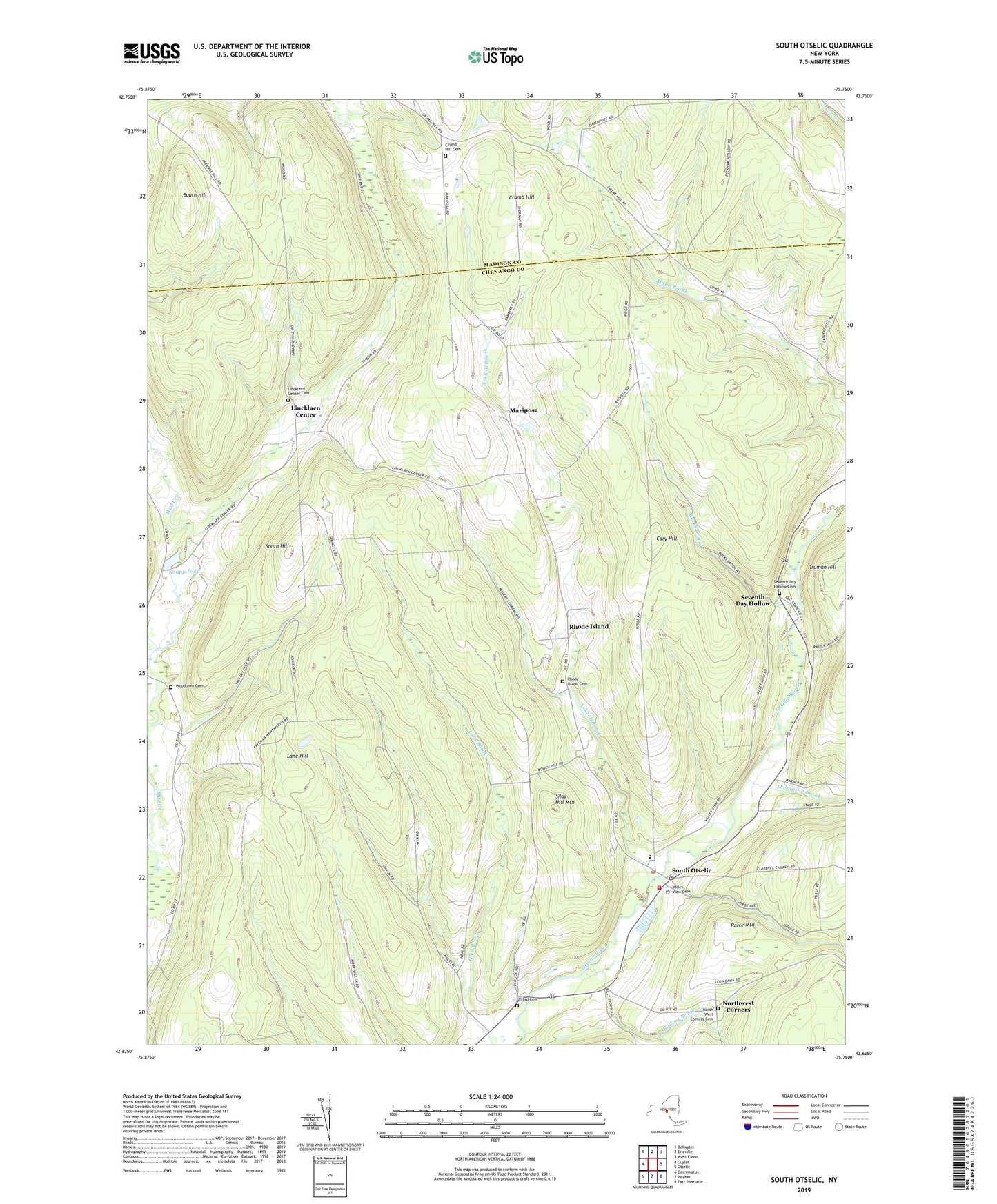
South Otselic New York US Topo Map
Couldn't load pickup availability
2023 topographic map quadrangle South Otselic in the state of New York. Scale: 1:24000. Based on the newly updated USGS 7.5' US Topo map series, this map is in the following counties: Chenango, Madison. The map contains contour data, water features, and other items you are used to seeing on USGS maps, but also has updated roads and other features. This is the next generation of topographic maps. Printed on high-quality waterproof paper with UV fade-resistant inks.
Quads adjacent to this one:
West: Cuyler
Northwest: DeRuyter
North: Erieville
Northeast: West Eaton
East: Otselic
Southeast: East Pharsalia
South: Pitcher
Southwest: Cincinnatus
This map covers the same area as the classic USGS quad with code o42075f7.
Contains the following named places: Ashbell Brook, Bucks Brook, Camp Georgetown, Cary Hill, Crumb Hill, Crumb Hill Cemetery, First Baptist Church, Glading Brook, Knapp Pond, Lane Hill, Lane School, Lincklaen Center, Lincklaen Center Cemetery, Mariposa, Marstan Farms, North West Corners Cemetery, Northwest Corners, Otselic Valley Junior - Senior High School, Parce Mountain, Pond School, Rhode Island, Rhode Island Cemetery, Seventh Day Hollow, Seventh Day Hollow Cemetery, Silas Hill Mountain, South Hill, South Otselic, South Otselic Post Office, South Otselic Volunteer Fire Department, Thompson Brook, Town of Lincklaen, Truman Hill, Ufford Cemetery, Ufford Corners, Valley View Cemetery, Waldron Corners, Woodlawn Cemetery, ZIP Codes: 13052, 13124, 13155