MyTopo
Pitcher New York US Topo Map
Couldn't load pickup availability
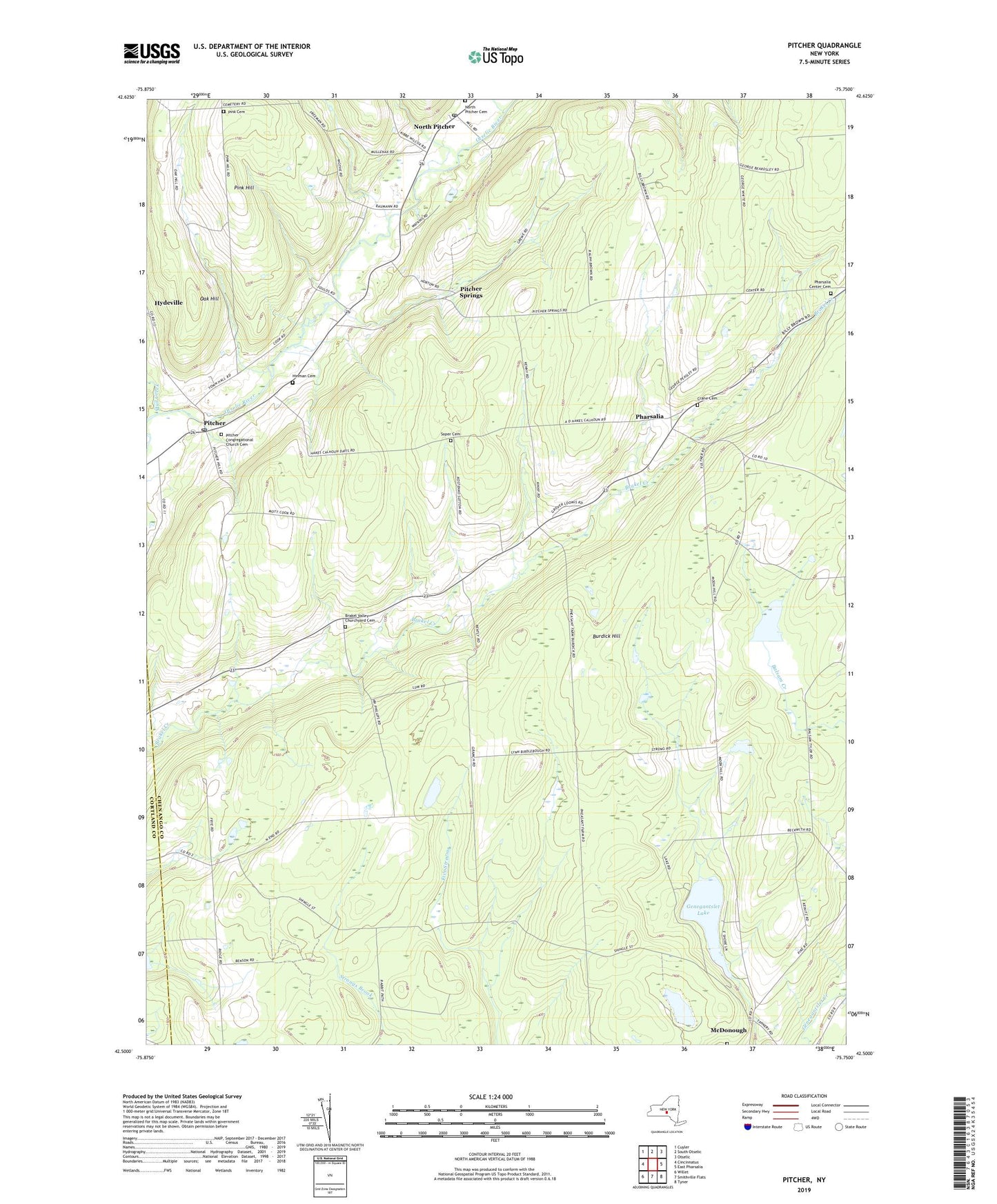
2023 topographic map quadrangle Pitcher in the state of New York. Scale: 1:24000. Based on the newly updated USGS 7.5' US Topo map series, this map is in the following counties: Chenango, Cortland. The map contains contour data, water features, and other items you are used to seeing on USGS maps, but also has updated roads and other features. This is the next generation of topographic maps. Printed on high-quality waterproof paper with UV fade-resistant inks.
Quads adjacent to this one:
West: Cincinnatus
Northwest: Cuyler
North: South Otselic
Northeast: Otselic
East: East Pharsalia
Southeast: Tyner
South: Smithville Flats
Southwest: Willet
This map covers the same area as the classic USGS quad with code o42075e7.
Contains the following named places: Brakel Church, Brakel Valley Churchyard Cemetery, Burdick Hill, Crane Cemetery, Genegantslet Lake, German Five Corners, Glen Brook, Hinman Cemetery, Mud Creek, North Pitcher, North Pitcher Cemetery, North Pitcher Post Office, Oak Hill, Pharsalia, Pharsalia Center Cemetery, Pink Cemetery, Pink Hill, Pitcher, Pitcher Congregational Church Cemetery, Pitcher Post Office, Pitcher Springs, School Number 1, School Number 2, School Number 3, School Number 4, School Number 6, Soper Cemetery, Town of Pitcher, Union Cemetery, ZIP Codes: 13136, 13801