MyTopo
Clermont New York US Topo Map
Couldn't load pickup availability
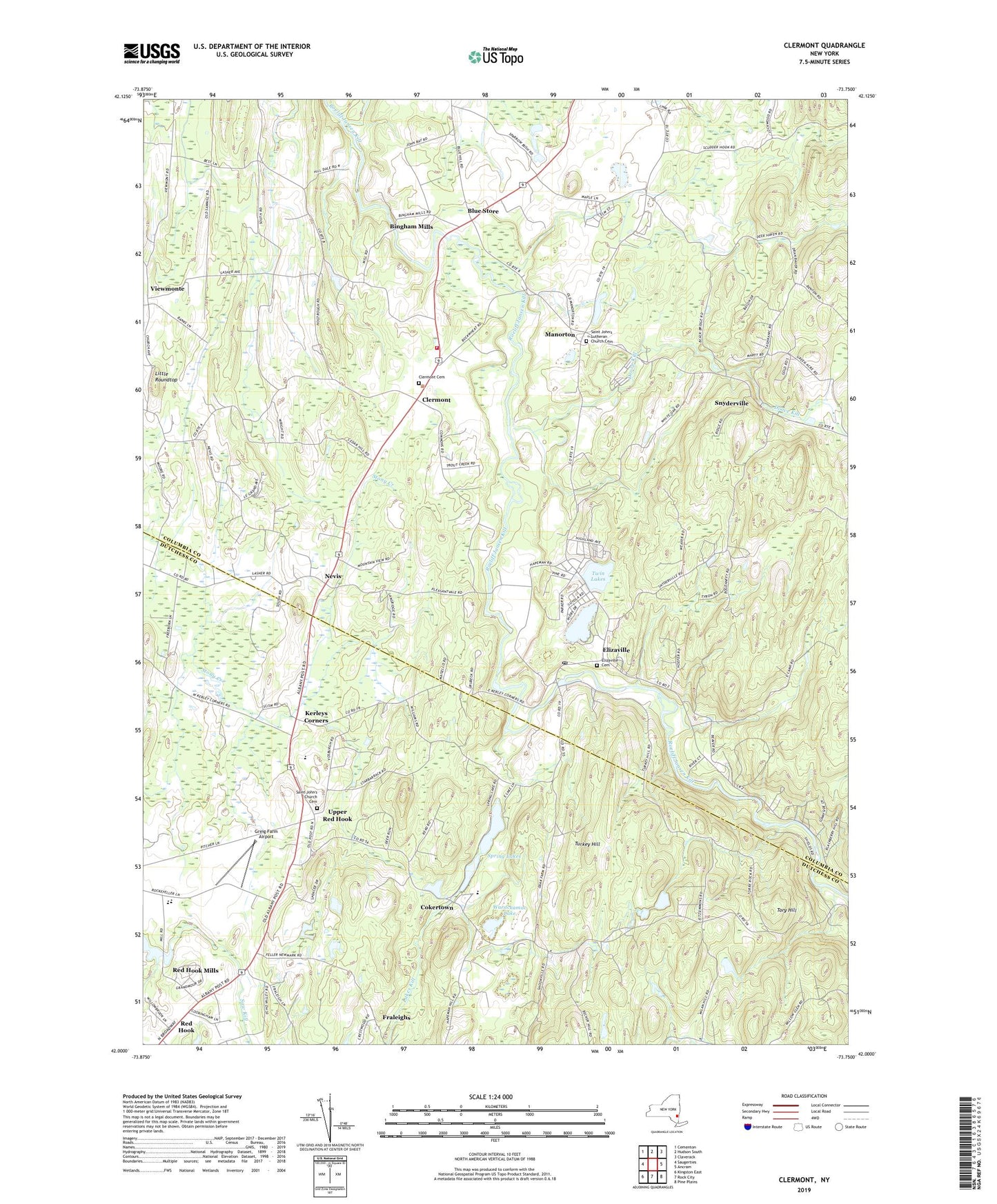
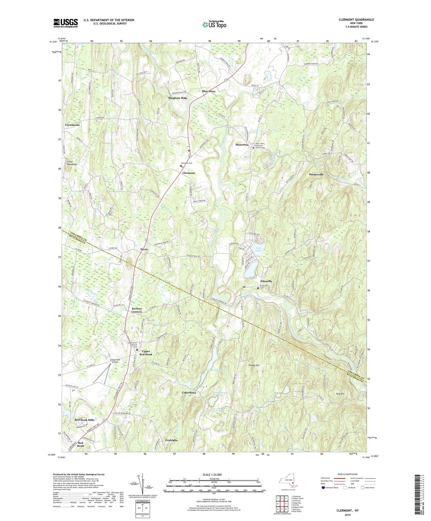
2019 topographic map quadrangle Clermont in the state of New York. Scale: 1:24000. Based on the newly updated USGS 7.5' US Topo map series, this map is in the following counties: Columbia, Dutchess. The map contains contour data, water features, and other items you are used to seeing on USGS maps, but also has updated roads and other features. This is the next generation of topographic maps. Printed on high-quality waterproof paper with UV fade-resistant inks.
Quads adjacent to this one:
West: Saugerties
Northwest: Cementon
North: Hudson South
Northeast: Claverack
East: Ancram
Southeast: Pine Plains
South: Rock City
Southwest: Kingston East
Contains the following named places: Alison Vineyards, Bingham Mills, Blue Store, Brook N Wood Family Campground, Camp Columbia, Christ Lutheran Church, Clermont, Clermont Bible Church, Clermont Cemetery, Clermont Town Hall, Clermont Volunteer Fire Department Station 1, Cokertown, Cokertown School, Devereux in New York School, Doove Kill, Elizaville, Elizaville Cemetery, Elizaville Methodist Church, Elizaville Post Office, Fraleighs, Greig Farm, Greig Farm Airport, Kerleys Corners, Little Roundtop, Manorton, Mead Orchards, Migliorelli Farm, Mill Road Intermediate School, Mill Road Primary School, Nevis, New Beginnings Assembly of God Church, Oriole Orchards, Red Hook Mills, Red Hook Residential Center, Rider Farm, Rose Hill Farm, Saint Johns Church, Saint John's Church Cemetery, Saint John's Lutheran Church Cemetery, Saint John's Reformed Church, Saint Luke's Church, School Number 3, Snyderville, Snyderville School, SOP Airport, Spring Lakes, Tory Hill, Town of Clermont, Turkana Farm, Turkey Hill, Twin Lakes, Upper Red Hook, Upper Red Hook Census Designated Place, Viewmonte, Warackamac Lake, Wil-Hi Farms, ZIP Codes: 12523, 12526, 12571, 12583