MyTopo
Clymer New York US Topo Map
Couldn't load pickup availability
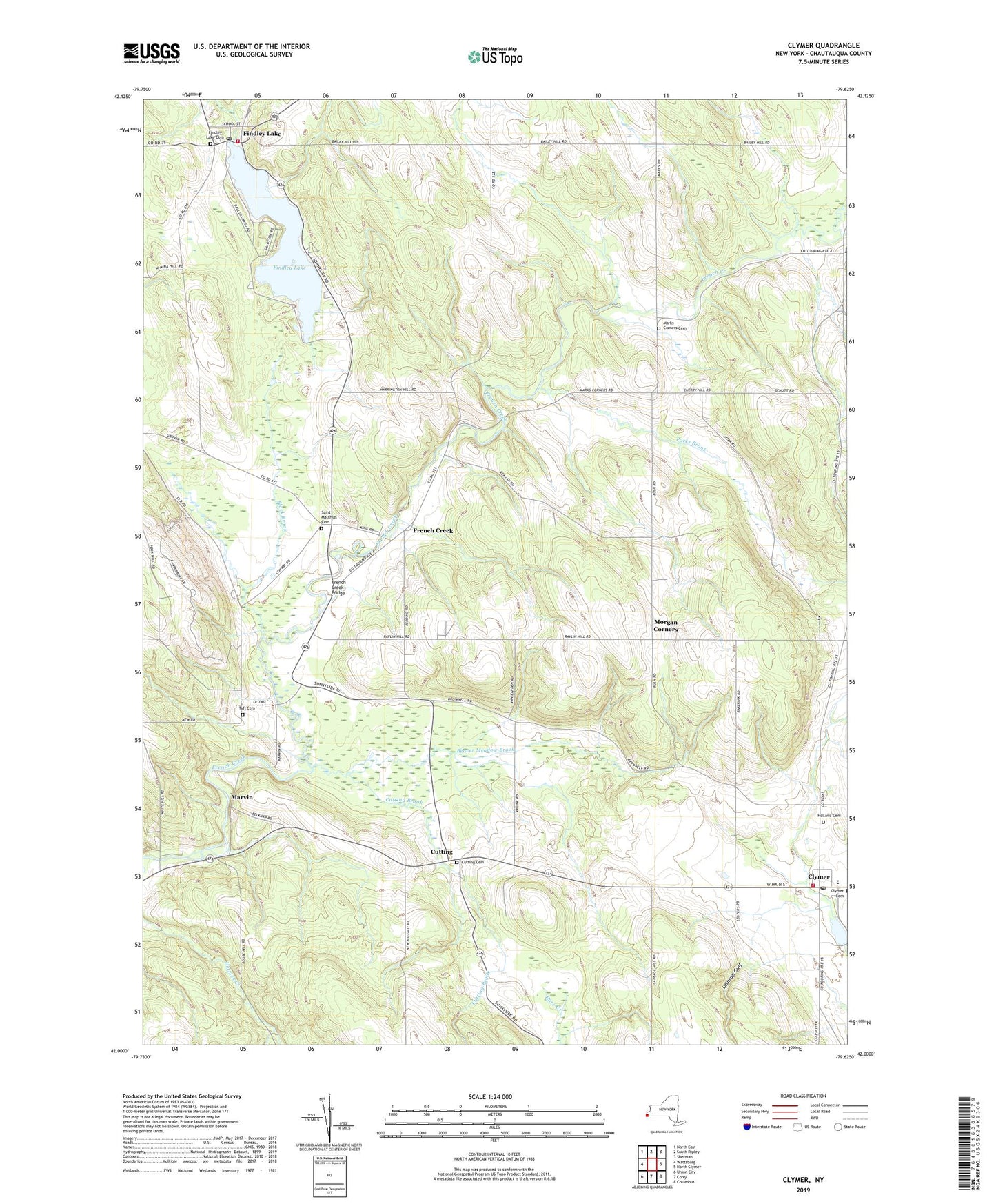
2019 topographic map quadrangle Clymer in the state of New York. Scale: 1:24000. Based on the newly updated USGS 7.5' US Topo map series, this map is in the following counties: Chautauqua. The map contains contour data, water features, and other items you are used to seeing on USGS maps, but also has updated roads and other features. This is the next generation of topographic maps. Printed on high-quality waterproof paper with UV fade-resistant inks.
Quads adjacent to this one:
West: Wattsburg
Northwest: North East
North: South Ripley
Northeast: Sherman
East: North Clymer
Southeast: Columbus
South: Corry
Southwest: Union City
Contains the following named places: Abbe Reformed Church, Alder Bottom Creek, Alexander Findley Community Library, Beaver Meadow Brook, Black Brook, Boozel Farms, Cabhi Farm, Camp Findley, Clymer, Clymer - French Creek Free Library, Clymer Central School, Clymer Fire Department, Clymer Post Office, Cutting, Cutting Brook, Cutting Cemetery, Cutting Community Church, Dunnewold Farms, Edwards Chapel, Findlay Lake Volunteer Fire Department, Findley Lake, Findley Lake Cemetery, Findley Lake Post Office, Findley Lake United Methodist Church, French Creek, French Creek Bridge, Holland Cemetery, Lathrup Gulf, Marks Corners, Marks Corners Cemetery, Marvin, Morgan Corners, North Clymer United Methodist Church, Paradise Bay Park, Parks Brook, Pineview School, Saint Matthias Cemetery, Saint Matthias Church, Taft Cemetery, Town of French Creek, Willink Farms, ZIP Code: 14724