MyTopo
Wattsburg Pennsylvania US Topo Map
Couldn't load pickup availability
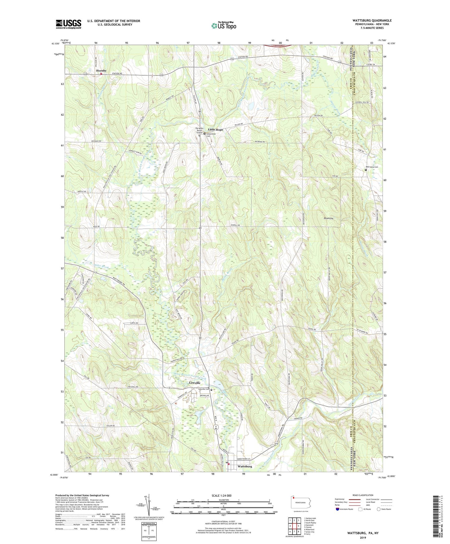
2023 topographic map quadrangle Wattsburg in the states of Pennsylvania, New York. Scale: 1:24000. Based on the newly updated USGS 7.5' US Topo map series, this map is in the following counties: Erie, Chautauqua. The map contains contour data, water features, and other items you are used to seeing on USGS maps, but also has updated roads and other features. This is the next generation of topographic maps. Printed on high-quality waterproof paper with UV fade-resistant inks.
Quads adjacent to this one:
West: Hammett
Northwest: Harborcreek
North: North East
Northeast: South Ripley
East: Clymer
Southeast: Corry
South: Union City
Southwest: Waterford
This map covers the same area as the classic USGS quad with code o42079a7.
Contains the following named places: Alder Brook, Ashton Corners, Bailey Brook, Borough of Wattsburg, Colts Station, Darrow Brook, Drumlins, Erie County Airport, Greenfield Cemetery, Greenfield Township Elementary School, Greenfield Township Volunteer Fire Company Station 70, Herrick Creek, Hornby, Little Hope, Lowville, Lowville Cemetery, Lowville Pit 1, Old Miller Burial Ground, Seneca High School, State Game Lands Number 155, State Game Lands Number 191, Strawberry Acres Airport, Townley Run, Township of Greenfield, Township of Venango, Wattsburg, Wattsburg Hose Company Station 17, Wattsburg Post Office, West Mina Cemetery, ZIP Code: 16442