MyTopo
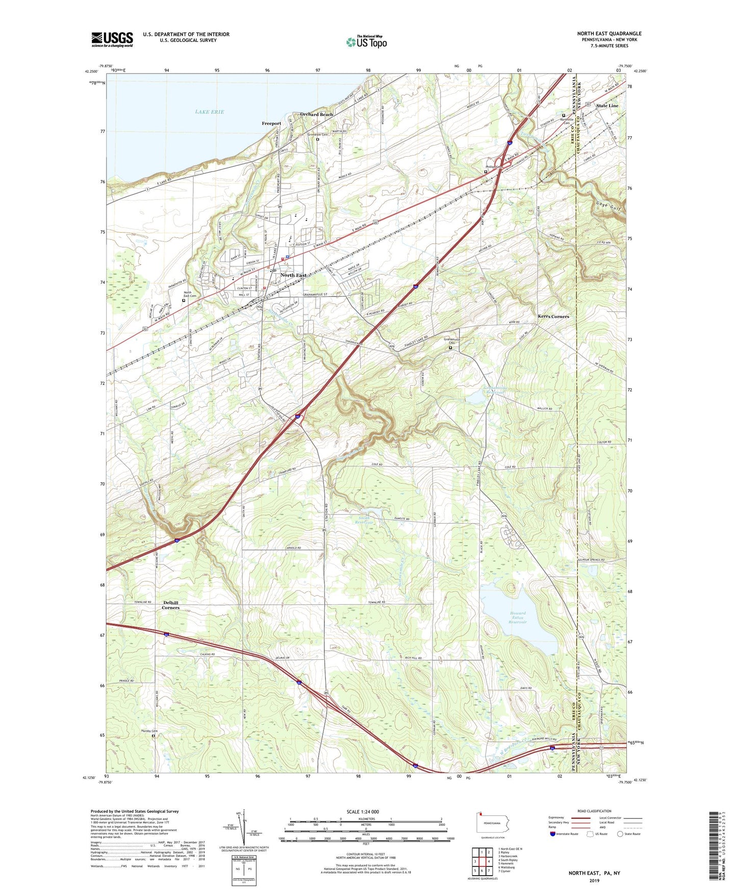
North East Pennsylvania US Topo Map
Couldn't load pickup availability
2023 topographic map quadrangle North East in the states of Pennsylvania, New York. Scale: 1:24000. Based on the newly updated USGS 7.5' US Topo map series, this map is in the following counties: Erie, Chautauqua. The map contains contour data, water features, and other items you are used to seeing on USGS maps, but also has updated roads and other features. This is the next generation of topographic maps. Printed on high-quality waterproof paper with UV fade-resistant inks.
Quads adjacent to this one:
West: Harborcreek
Northeast: Ripley
East: South Ripley
Southeast: Clymer
South: Wattsburg
Southwest: Hammett
This map covers the same area as the classic USGS quad with code o42079b7.
Contains the following named places: Borough of North East, Camp Cayuga Dam, Carris Fruit Farm, Crescent Hose Company Station 21, Delhill Corners, Earl C Davis Elementary School, Eaton Dam, Freeport, Freeport Yacht Club, Fuller Hose Company North East Fire Department Erie County Station 20, Gage Gulf, Gibson Park, Grahamville Cemetery, Grahamville Reservoir, Grahamville Reservoir Dam, Greenfield Church, Grimshaw Cemetery, Heard Memorial School, Hornby Cemetery, Howard Eaton Reservoir, Immanuel United Methodist Church, Kerrs Corners, Lake View Country Club, Merryhurst College, North East, North East Cemetery, North East Christian Academy, North East High School, North East Middle School, North East Police Department, North East Post Office, Northville Cemetery, Orchard Beach, Papermill Hollow Airport, Phillips Cemetery, Praise Cathedral Church of God, Saint Gregorys School, Saint Peters Church, Sixteenmile Creek, Smith Reservoir, State Game Lands Number 163, State Line, Township of North East, WHYP-AM (North East), WRKT-FM 101, WRTS-FM 104, ZIP Code: 16428