MyTopo
Constableville New York US Topo Map
Couldn't load pickup availability
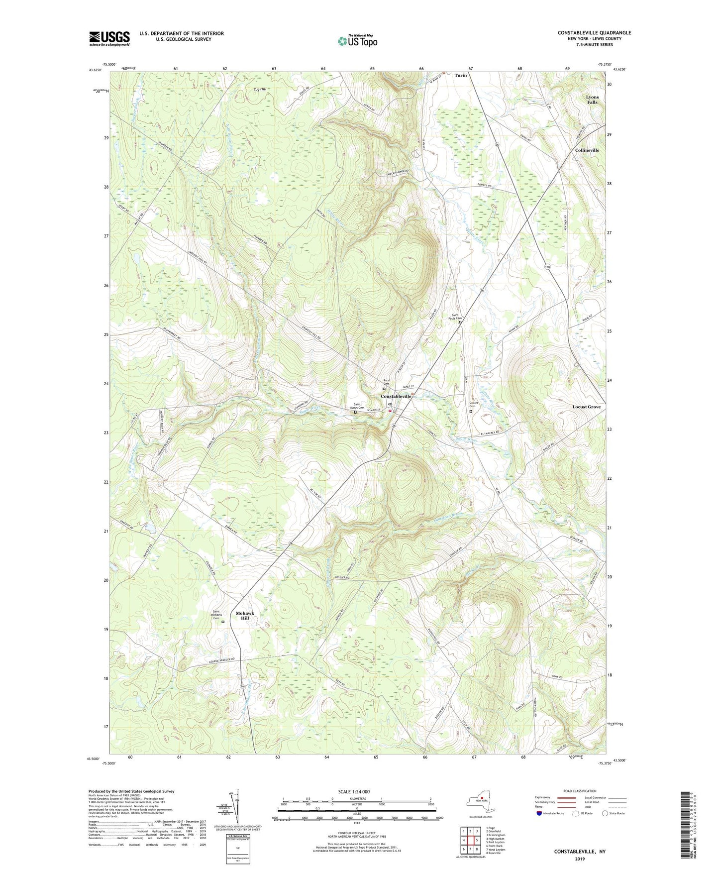
2023 topographic map quadrangle Constableville in the state of New York. Scale: 1:24000. Based on the newly updated USGS 7.5' US Topo map series, this map is in the following counties: Lewis. The map contains contour data, water features, and other items you are used to seeing on USGS maps, but also has updated roads and other features. This is the next generation of topographic maps. Printed on high-quality waterproof paper with UV fade-resistant inks.
Quads adjacent to this one:
West: High Market
Northwest: Page
North: Glenfield
Northeast: Brantingham
East: Port Leyden
Southeast: Boonville
South: West Leyden
Southwest: Point Rock
This map covers the same area as the classic USGS quad with code o43075e4.
Contains the following named places: Collins Cemetery, Collinsville, Constableville, Constableville Post Office, Constableville Rural Cemetery, Constableville Volunteer Fire Company, Mohawk Hill, North Branch Sugar River, Olmstead Brook, Potters Corners, Saint Johns Church, Saint Marys Cemetery, Saint Michaels Cemetery, Saint Pauls Cemetery, Saint Pauls Church, Stucky Creek, Town of Leyden, Tug Hill, Village of Constableville, West Branch Sugar River, White River