MyTopo
Crown Point New York US Topo Map
Couldn't load pickup availability
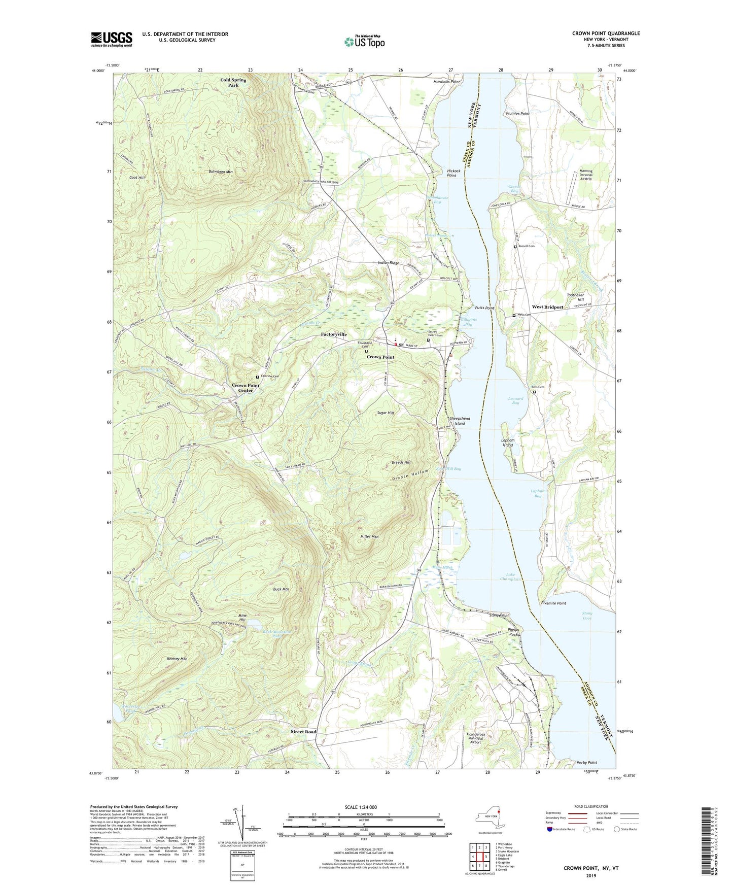
2023 topographic map quadrangle Crown Point in the states of New York, Vermont. Scale: 1:24000. Based on the newly updated USGS 7.5' US Topo map series, this map is in the following counties: Essex, Addison. The map contains contour data, water features, and other items you are used to seeing on USGS maps, but also has updated roads and other features. This is the next generation of topographic maps. Printed on high-quality waterproof paper with UV fade-resistant inks.
Quads adjacent to this one:
West: Eagle Lake
Northwest: Witherbee
North: Port Henry
Northeast: Snake Mountain
East: Bridport
Southeast: Orwell
South: Ticonderoga
Southwest: Graphite
Contains the following named places: Bliss Cemetery, Braisted Brook, Breeds Hill, Buck Mountain, Buck Mountain Pond, Bulwagga Mountain, Burdick Crossing, Champlain Speedway, Cold Spring Park, Coot Hill, Crown Point, Crown Point Bible Church, Crown Point Center, Crown Point Central School, Crown Point Fire Department, Crown Point Post Office, Dibble Hollow, Factoryville, Fairview Cemetery, First Congregational Church, Fivemile Creek, Fivemile Point, Fivemile Point Light, Forestdale Cemetery, Giards Bay, Gilligans Bay, Grant Brook, Hammond Library of Crown Point, Hickock Point, Indian Ridge, Jones Dock, Keeney Mountain, Kerby Point, Lake School, Lapham Bay, Lapham Island, Leonard Bay, Manning Personal Airstrip, Miller Marsh, Miller Mountain, Mine Hill, Moniter Bay Park, Murdocks Point, Phelps Brook, Phelps Rocks, Plumies Point, Porters Marsh, Putnam Creek, Putts Point, Russell Cemetery, Sacred Heart Cemetery, Sacred Heart Church, Schoolhouse Bay, Sheepshead Island, Skyline Drive-In, Spar Mill Bay, Spar Mine, Stony Cove, Stony Point, Street Road, Sugar Hill, Ticonderoga Municipal Airport, Wells Cemetery, West Bridport, White Church, Worcester Pond