MyTopo
Dugway New York US Topo Map
Couldn't load pickup availability
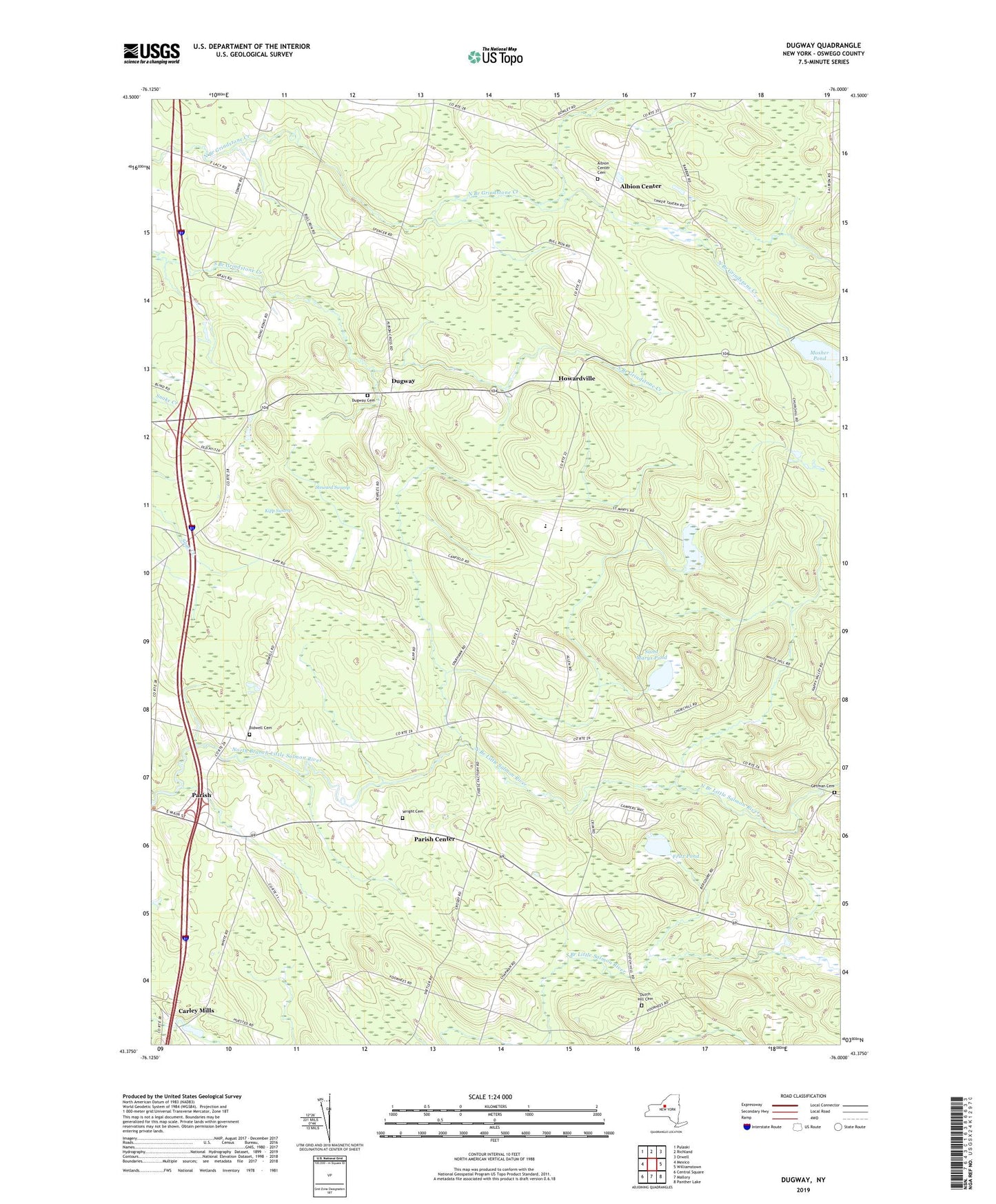
2019 topographic map quadrangle Dugway in the state of New York. Scale: 1:24000. Based on the newly updated USGS 7.5' US Topo map series, this map is in the following counties: Oswego. The map contains contour data, water features, and other items you are used to seeing on USGS maps, but also has updated roads and other features. This is the next generation of topographic maps. Printed on high-quality waterproof paper with UV fade-resistant inks.
Quads adjacent to this one:
West: Mexico
Northwest: Pulaski
North: Richland
Northeast: Orwell
East: Williamstown
Southeast: Panther Lake
South: Mallory
Southwest: Central Square
Contains the following named places: Albion Center, Albion Center Cemetery, Altmar - Parish - Williamstown High School, Altmar - Parish - Williamstown Middle School, Barber Corners, Bidwell Cemetery, Carley Mills, Chezwick Estates Mobile Home Park, Dugway, Dugway Cemetery, Dutch Hill Cemetery, Faith Church of the Nazarene, Fritz Pond, Getman Cemetery, Howardville, Kipp Swamp, Liberty Park Mobile Home Park, Maple Corners, Merritt Corners, Mosher Corners, Mosher Pond, Paris Hastings Presbyterian Church, Parish Center, Saint Marys Pond, School Number 10, School Number 12, School Number 2, School Number 4, School Number 5, School Number 6, School Number 8, Steward Swamp, Town of Albion, Town of Parish, Wright Cemetery, ZIP Code: 13131