MyTopo
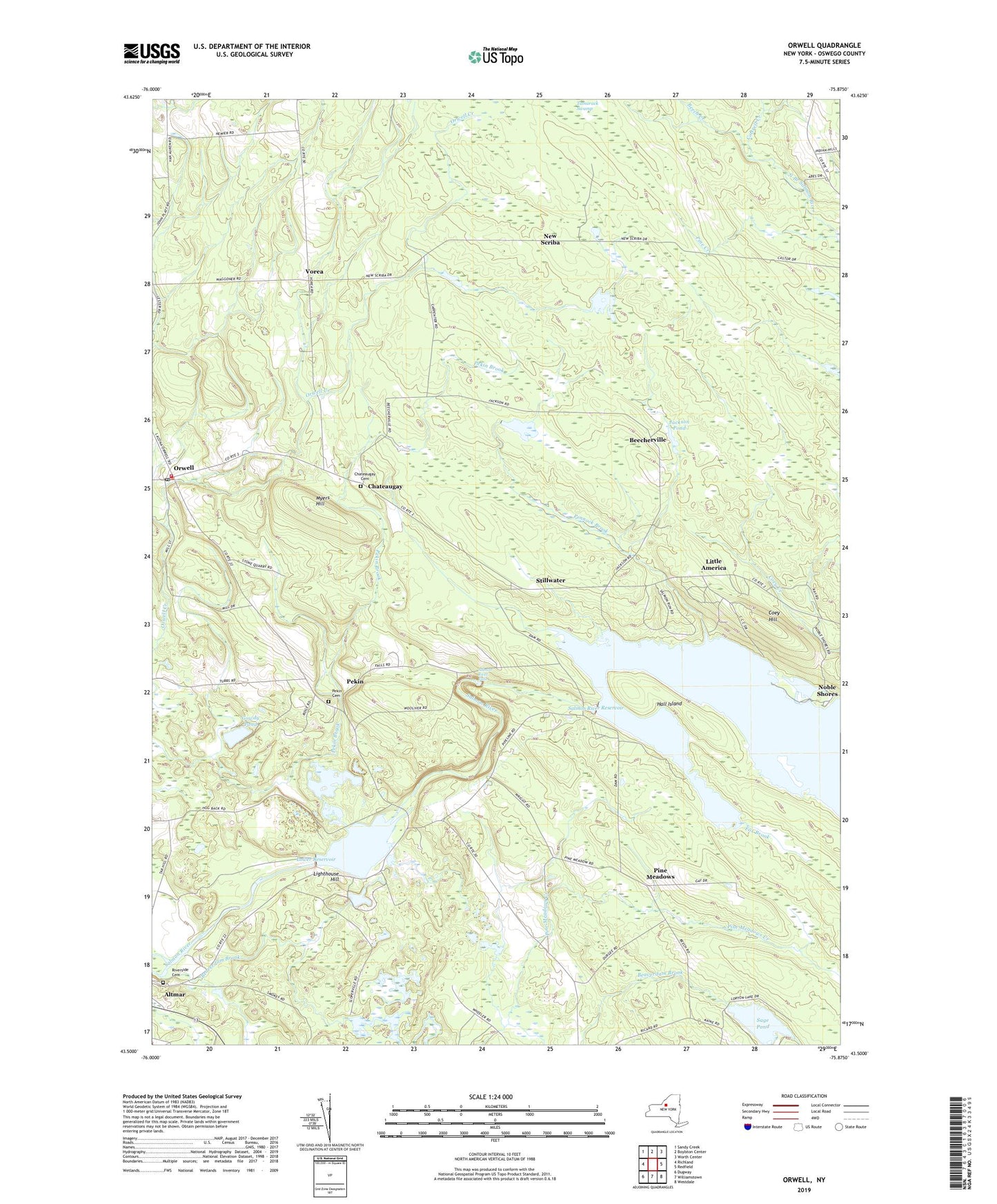
Orwell New York US Topo Map
Couldn't load pickup availability
2023 topographic map quadrangle Orwell in the state of New York. Scale: 1:24000. Based on the newly updated USGS 7.5' US Topo map series, this map is in the following counties: Oswego. The map contains contour data, water features, and other items you are used to seeing on USGS maps, but also has updated roads and other features. This is the next generation of topographic maps. Printed on high-quality waterproof paper with UV fade-resistant inks.
Quads adjacent to this one:
West: Richland
Northwest: Sandy Creek
North: Boylston Center
Northeast: Worth Center
East: Redfield
Southeast: Westdale
South: Williamstown
Southwest: Dugway
This map covers the same area as the classic USGS quad with code o43075e8.
Contains the following named places: Beaverdam Brook, Beech Creek, Beecherville, Bennett Ridge, Chateaugay, Chateaugay Cemetery, Coey Hill, Cogswell Free Library, Cottrell Creek, Gowdy Pond, Hall Island, Heritage Hill Farm, Jackson Pond, Lighthouse Hill, Little America, Lower Reservoir, Myers Hill, New Scriba, Noble Shores, Orwell, Orwell Post Office, Orwell Volunteer Fire Company, Pekin, Pekin Hill Cemetery, Pennock Brook, Pine Creek, Pine Meadows, Pine Meadows Creek, Pine Meadows Wesleyan Church, Powerhouse School, Riverside Cemetery, Sage Pond, Salmon River Dam, Salmon River Falls, Salmon River Fish Hatchery, Salmon River Reservoir, School Number 3, School Number 4, School Number 6, School Number 7, School Number 8, School Number 9, Scotch Pine Manor Mobile Home Park, Stillwater, Tamarack Swamp, Town of Orwell, Vorea, Vorea Community Church, WSCP-FM (Pulaski), ZIP Code: 13144