MyTopo
Richland New York US Topo Map
Couldn't load pickup availability
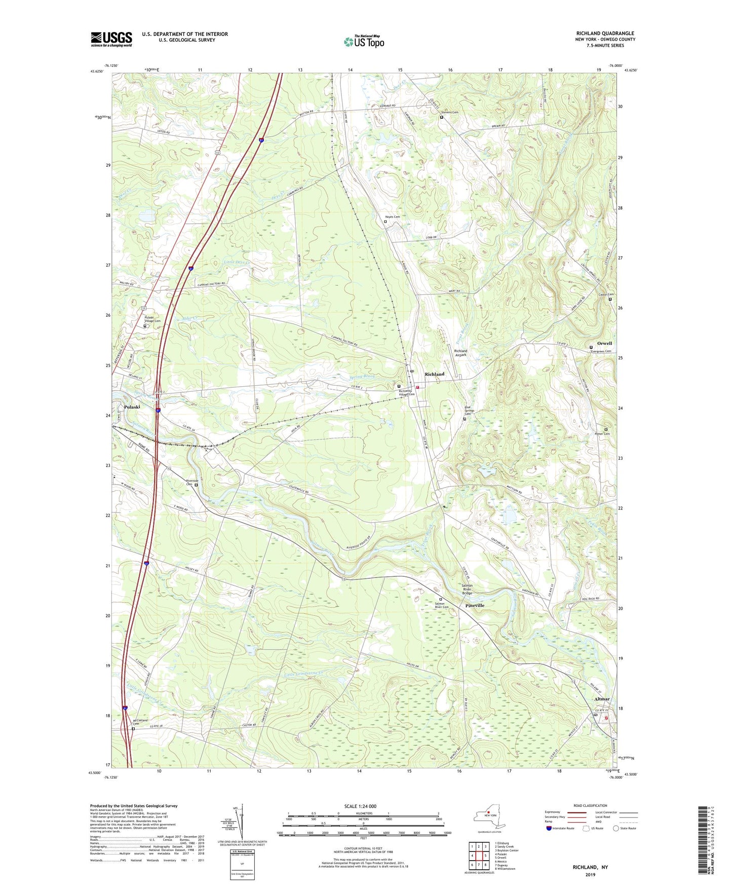
2023 topographic map quadrangle Richland in the state of New York. Scale: 1:24000. Based on the newly updated USGS 7.5' US Topo map series, this map is in the following counties: Oswego. The map contains contour data, water features, and other items you are used to seeing on USGS maps, but also has updated roads and other features. This is the next generation of topographic maps. Printed on high-quality waterproof paper with UV fade-resistant inks.
Quads adjacent to this one:
West: Pulaski
Northwest: Ellisburg
North: Sandy Creek
Northeast: Boylston Center
East: Orwell
Southeast: Williamstown
South: Dugway
Southwest: Mexico
This map covers the same area as the classic USGS quad with code o43076e1.
Contains the following named places: Adirondack Manor Assisted Living Facility, Altmar, Altmar Census Designated Place, Altmar Fire Department, Altmar Post Office, Beulah Park Campground, Blue Springs Cemetery, Castor Cemetery, Castor Corners, Centerville, Evergreen Cemetery, Greater Victory Fellowship Church, Grindstone Farm, McClelland Cemetery, Northern Oswego County Ambulance Service, Noyes Cemetery, Noyes Woods, Orwell Creek, Oswego County at Pulaski Heliport, Pekin Brook, Pineville, Potter Cemetery, Pulaski Airport, Pulaski Calvary Baptist Church, Pulaski Junior - Senior High School, Pulaski Village Cemetery, Richland, Richland Airpark, Richland Christian Church, Richland Post Office, Richland Village Cemetery, Richland Volunteer Fire Department, Riverside Cemetery, Salmon River Bridge, Salmon River Cemetery, School Number 13, School Number 19, School Number 2, School Number 3, School Number 4, School Number 5, School Number 6, Spring Brook, Stevens Cemetery, Stoney's Pineville Campground, Streamside Golf Course and Country Club, The Church of Jesus Christ of Latter Day Saints, Trout Brook, Union School, Village of Altmar