MyTopo
East Chatham New York US Topo Map
Couldn't load pickup availability
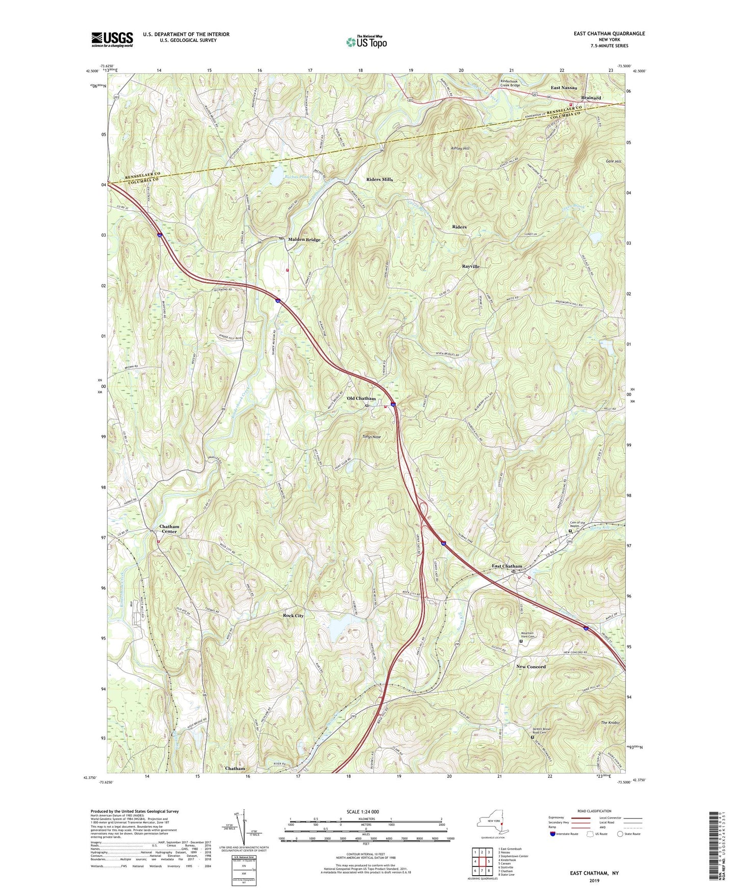
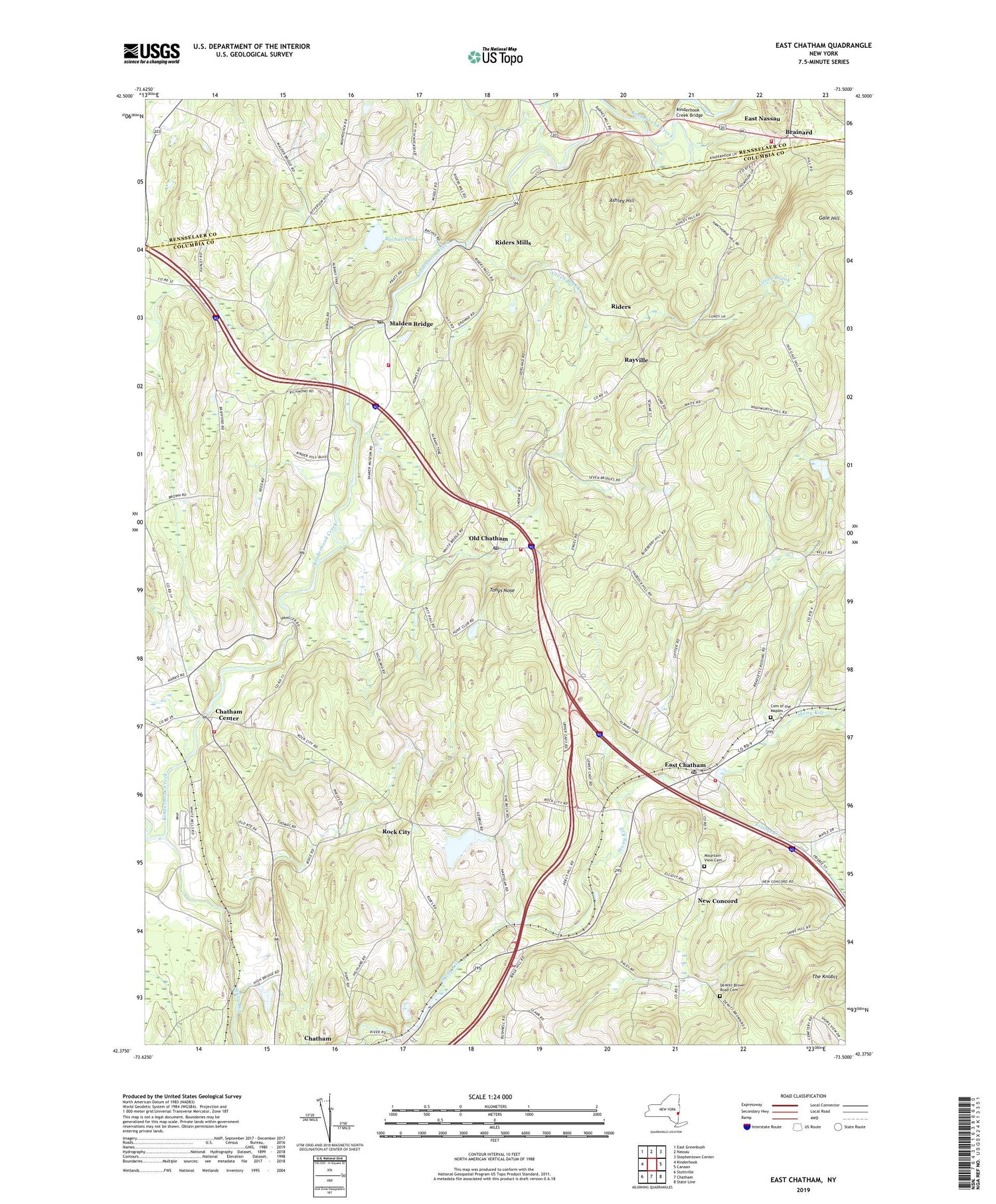
2019 topographic map quadrangle East Chatham in the state of New York. Scale: 1:24000. Based on the newly updated USGS 7.5' US Topo map series, this map is in the following counties: Columbia, Rensselaer. The map contains contour data, water features, and other items you are used to seeing on USGS maps, but also has updated roads and other features. This is the next generation of topographic maps. Printed on high-quality waterproof paper with UV fade-resistant inks.
Quads adjacent to this one:
West: Kinderhook
Northwest: East Greenbush
North: Nassau
Northeast: Stephentown Center
East: Canaan
South: Chatham
Southwest: Stottville
Contains the following named places: Ashley Hill, Bachus Pond, Brainard, Breezy Hills Mobile Home Park, Canaan Endpoint Toll Plaza, Cemetery of the Maples, Chatham Center, Chatham Center United Methodist Church, DeWitt Brown Road Cemetery, East Chatham, East Chatham Post Office, East Chatham Volunteer Fire Company, Frisbee Creek, Gale Hill, Golden Acres, Green Brook, Kinderhook Creek Bridge, Malden Bridge, Malden Bridge Post Office, Mountain View Cemetery, New Concord, Old Chatham, Old Chatham Post Office, Rayville, Riders, Riders Mills, Riders Mills School, Rock City, Saint Joseph Church, Shaker Museum, Stony Kill, Sutherland Pond, TGP-254 Heliport, The Knobit, Tonys Nose, Town of Chatham, Tri Village Volunteer Fire Company Chatham Center Station 2, Tri Village Volunteer Fire Company Malden Bridge Station 3, Tri Village Volunteer Fire Company Old Chatham Station 1, Tsatsawassa Protective Fire Company, Veeder Memorial Church, ZIP Codes: 12024, 12060, 12115, 12136