MyTopo
Stephentown Center New York US Topo Map
Couldn't load pickup availability
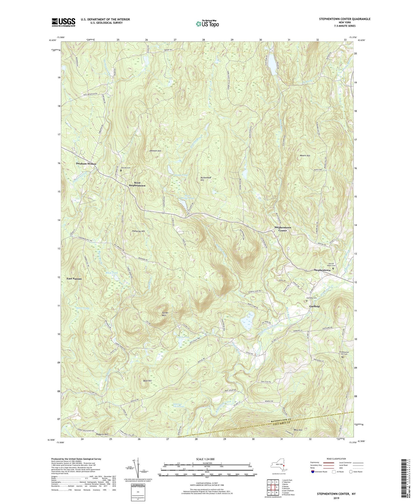
2023 topographic map quadrangle Stephentown Center in the state of New York. Scale: 1:24000. Based on the newly updated USGS 7.5' US Topo map series, this map is in the following counties: Rensselaer, Columbia. The map contains contour data, water features, and other items you are used to seeing on USGS maps, but also has updated roads and other features. This is the next generation of topographic maps. Printed on high-quality waterproof paper with UV fade-resistant inks.
Quads adjacent to this one:
West: Nassau
Northwest: Averill Park
North: Taborton
Northeast: Berlin
East: Hancock
Southeast: Pittsfield West
South: Canaan
Southwest: East Chatham
This map covers the same area as the classic USGS quad with code k42073e3.
Contains the following named places: Alps Family Campground, Bald Hill, Black Pond, Black River, Black River Pond, Buckwheat Hill, Capital District Forest and Game Refuge, Dunham Hollow, East Brook, Garfield, Garfield Cemetery, Hillside Cemetery, Huff Brook, Johnson Hill, Moore Hill, Pomeroy Hill, Presbyterian Hill Cemetery, Roaring Brook, Roberts Hill, Rocky Brook, Sabarney Gile Swamp, Sacred Heart Cemetery, Seven Hill Firetower, Squaw Swamp, Stephentown Center, Stephentown Elementary School, Stephentown Federated Church, Stephentown Memorial Library, Stone Bridge Pond, Stump Pond, Taplin Bourn, Taplin Pond, Town of Stephentown, Turner Mountain, West Brook, West Stephentown, West Stephentown Baptist Church, Zema's Nursery, ZIP Codes: 12168, 12169