
MyTopo
Forestport New York US Topo Map
Couldn't load pickup availability
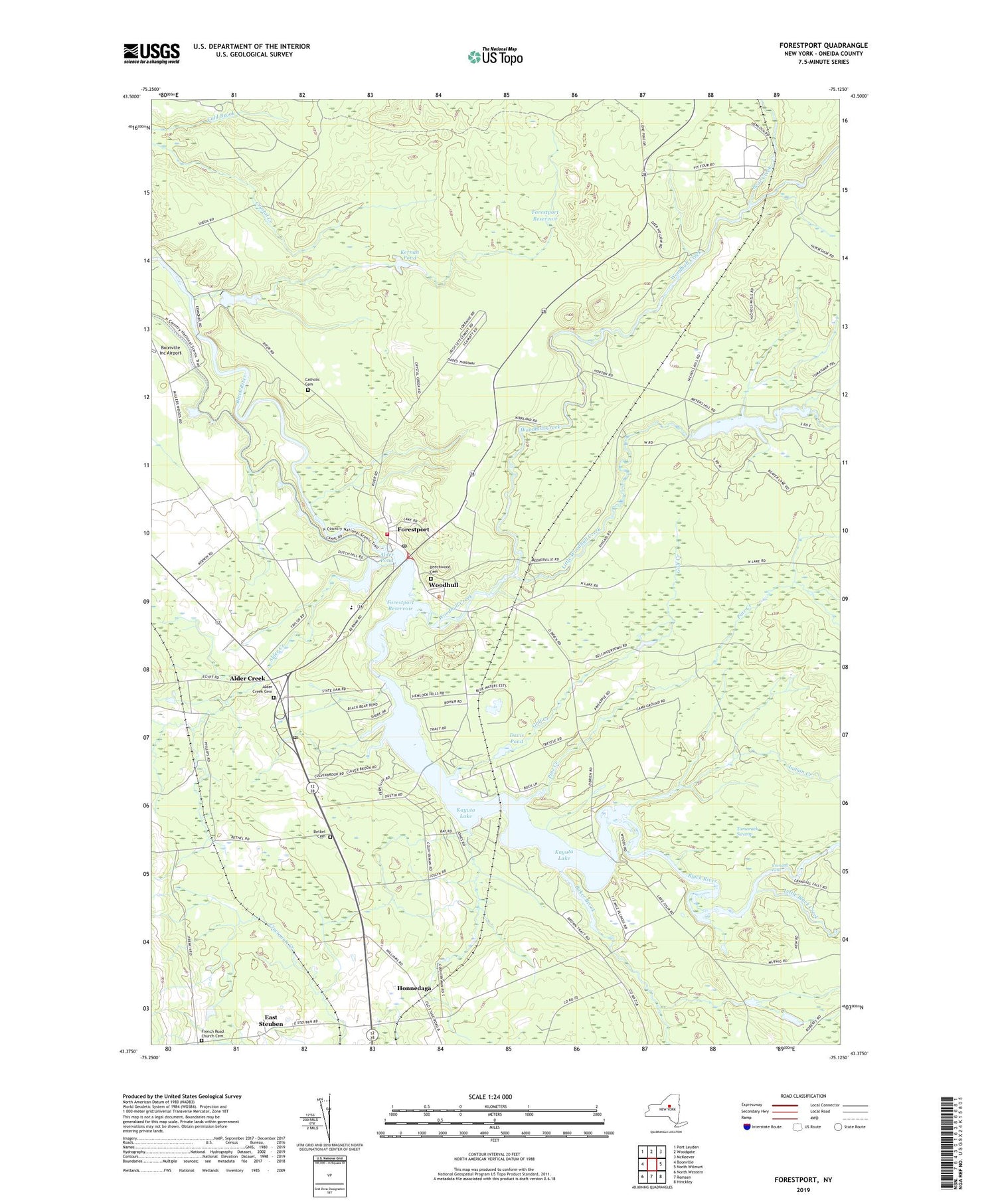
2019 topographic map quadrangle Forestport in the state of New York. Scale: 1:24000. Based on the newly updated USGS 7.5' US Topo map series, this map is in the following counties: Oneida. The map contains contour data, water features, and other items you are used to seeing on USGS maps, but also has updated roads and other features. This is the next generation of topographic maps. Printed on high-quality waterproof paper with UV fade-resistant inks.
Quads adjacent to this one:
West: Boonville
Northwest: Port Leyden
North: Woodgate
Northeast: McKeever
East: North Wilmurt
Southeast: Hinckley
South: Remsen
Southwest: North Western
Contains the following named places: Alder Creek, Alder Creek Cemetery, Alder Creek Golf Course, Alder Creek Post Office, Alder Creek Station, Alder Pond, Baker Brook, Bardwell Mill, Bear Creek, Bear Creek Lodge Golf Course, Beechwood Cemetery, Bethel Cemetery, Bethel Church, Catholic Cemetery, Crandall Falls, Davis Pond, East Steuben, Forestport, Forestport Elementary School, Forestport Fire Department, Forestport Post Office, Forestport Reservoir, Forestport Station, Forestport Town Wastewater Treatment Plant, French Road Church, French Road Church Cemetery, Gulf Creek, Honnedaga, Indian Creek, Kayuta Lake, Kayuta Lake Campground, Kernan Pond, Little Black Creek, Little Woodhull Creek, Muskrat Creek, Muskrat Lake, Pine Creek, School Number 18, Tamarack Swamp, Town of Forestport, Woodhull, Woodhull Creek, ZIP Code: 13301


