MyTopo
Woodgate New York US Topo Map
Couldn't load pickup availability
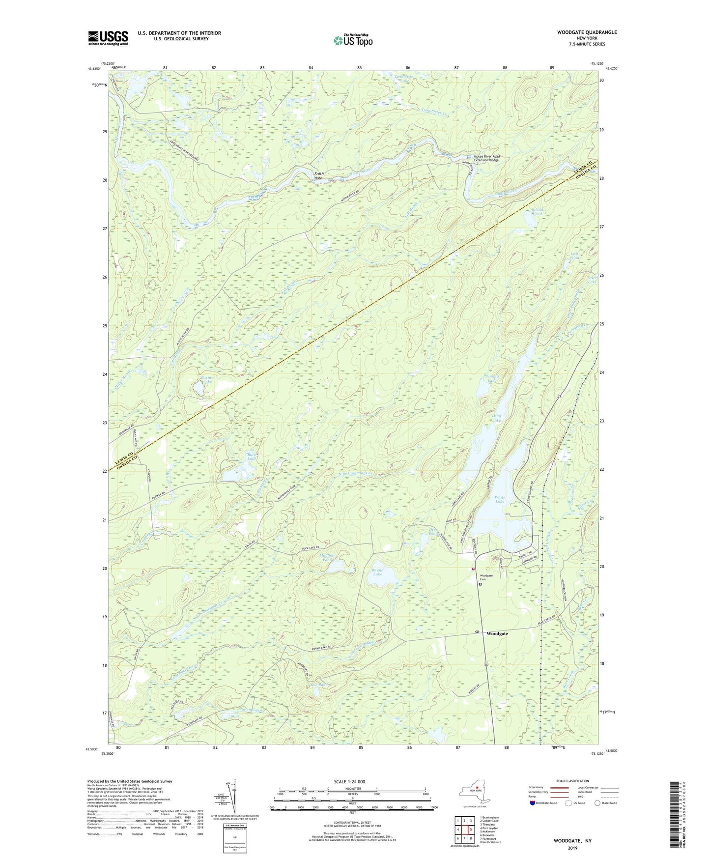
2023 topographic map quadrangle Woodgate in the state of New York. Scale: 1:24000. Based on the newly updated USGS 7.5' US Topo map series, this map is in the following counties: Oneida, Lewis. The map contains contour data, water features, and other items you are used to seeing on USGS maps, but also has updated roads and other features. This is the next generation of topographic maps. Printed on high-quality waterproof paper with UV fade-resistant inks.
Quads adjacent to this one:
West: Port Leyden
Northwest: Brantingham
North: Copper Lake
Northeast: Thendara
East: McKeever
Southeast: North Wilmurt
South: Forestport
Southwest: Boonville
Contains the following named places: Barnes Lake, Black Creek, Boonville Rod and Gun Club, Brandy Lake, Buck Lake, Camp Nazareth, Camp Russell, Caroline Creek, Cropsey Creek, Deer Pond, Doe Pond, Froth Hole, Graham Creek, Holiday House, Long Lake, Long Lake Outlet, Lost Pond, Masonic Home Camp, Moose River Road Extension Bridge, Mudhole Pond, Otter Lake Outlet, Poplar Pond, Porters Corners, Purgatory Creek, Round Lake, Round Pond, Sand Flats State Park, Silver Creek, Town of Lyonsdale, Twin Sister Creek, Twin Sister Lake, White Lake, White Lake Census Designated Place, White Lake Outlet, Woodgate, Woodgate Cemetery, Woodgate Free Library, Woodgate Post Office, Woodgate Volunteer Fire Department, ZIP Codes: 13433, 13494