MyTopo
North Western New York US Topo Map
Couldn't load pickup availability
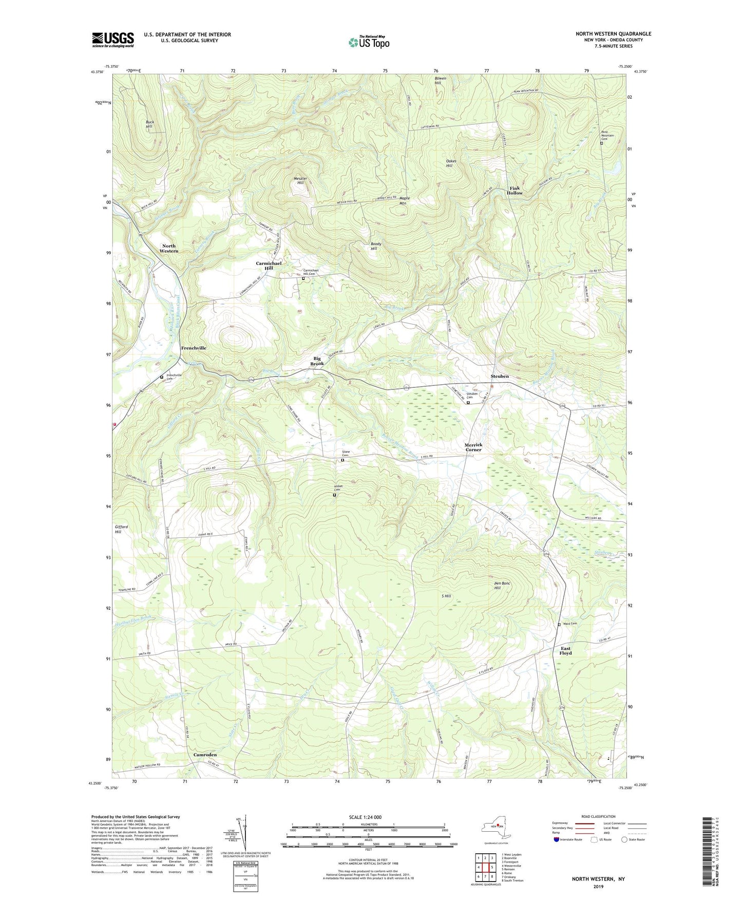
2023 topographic map quadrangle North Western in the state of New York. Scale: 1:24000. Based on the newly updated USGS 7.5' US Topo map series, this map is in the following counties: Oneida. The map contains contour data, water features, and other items you are used to seeing on USGS maps, but also has updated roads and other features. This is the next generation of topographic maps. Printed on high-quality waterproof paper with UV fade-resistant inks.
Quads adjacent to this one:
West: Westernville
Northwest: West Leyden
North: Boonville
Northeast: Forestport
East: Remsen
Southeast: South Trenton
South: Oriskany
Southwest: Rome
This map covers the same area as the classic USGS quad with code o43075c3.
Contains the following named places: Beaver Meadow Brook, Belle Maison Farms, Big Brook, Boody Hill, Bowen Hill, Buck Hill, Bunt Brook, Camroden, Camroden Golf Course, Carmichael Hill, Carmichael Hill Cemetery, Cyrus Brook, East Floyd, Fink Hollow, Flying Acres Airport, Frenchville, Frenchville Cemetery, Gifford Creek, Gifford Hill, Gifford Hill School, Gulf Creek, Holland Patent Central High School, Holland Patent Middle School, Lansing Kill, Maple Mountain, Merrick Corner, Meszler Hill, Nisbet Cemetery, North Western, North Western United Methodist Church, Oakes Hill, Pen Bonc Hill, Penn Mountain Cemetery, South Hill, Steuben, Steuben Corners Cemetery, Steuben United Methodist Church, Stone Cemetery, Stringer Brook, Tannery Brook, Town of Steuben, Volunteer Fire Company of Western, Ward Cemetery, Wells Creek, ZIP Codes: 13354, 13486