MyTopo
Furnaceville New York US Topo Map
Couldn't load pickup availability
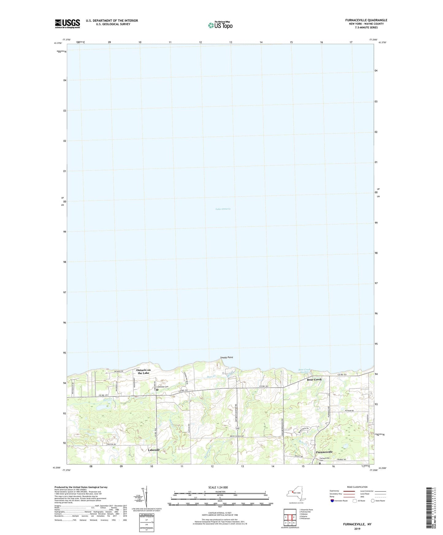
2019 topographic map quadrangle Furnaceville in the state of New York. Scale: 1:24000. Based on the newly updated USGS 7.5' US Topo map series, this map is in the following counties: Wayne, Monroe. The map contains contour data, water features, and other items you are used to seeing on USGS maps, but also has updated roads and other features. This is the next generation of topographic maps. Printed on high-quality waterproof paper with UV fade-resistant inks.
Quads adjacent to this one:
West: Ninemile Point
East: Pultneyville
Southeast: Williamson
South: Ontario
Southwest: Webster
Contains the following named places: Albright Fruit Farm, Bear Creek, Bear Creek Harbor, Deer Creek, Dennison Creek, Furnaceville, Furnaceville Cemetery, Lakeside, Lakeside Cemetery, Mill Creek, North Ontario United Methodist Church, Ontario on the Lake, R E Ginna Power Plant, School Number 1, School Number 13, School Number 8, Smoky Point, Town of Ontario Boat Landing