MyTopo
Galloo Island New York US Topo Map
Couldn't load pickup availability
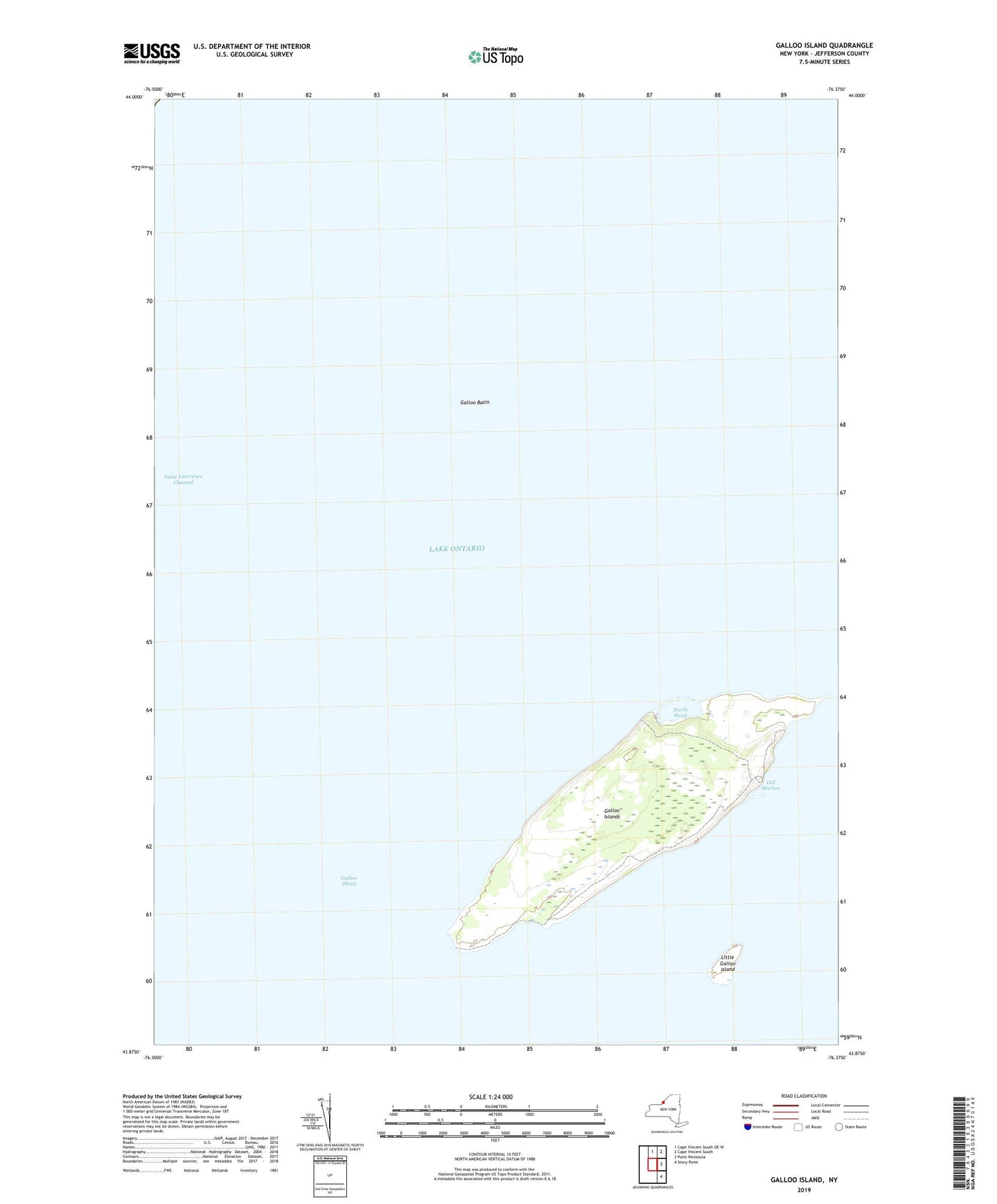
2023 topographic map quadrangle Galloo Island in the state of New York. Scale: 1:24000. Based on the newly updated USGS 7.5' US Topo map series, this map is in the following counties: Jefferson. The map contains contour data, water features, and other items you are used to seeing on USGS maps, but also has updated roads and other features. This is the next generation of topographic maps. Printed on high-quality waterproof paper with UV fade-resistant inks.
Quads adjacent to this one:
North: Cape Vincent South OE W
Northeast: Cape Vincent South
East: Point Peninsula
Southeast: Stony Point
This map covers the same area as the classic USGS quad with code o43076h4.
Contains the following named places: Galloo Basin, Galloo Island Lighthouse, Galloo Islands, Galloo Shoal, Gill Harbor, Little Galloo Island, North Pond, Saint Lawrence Channel